OpenStreetMap-logo OpenStreetMap

Blog for jmapb

Seneste blogindlæg

Adventures in Punycode

Skrevet af jmapb den 31 december 2022 på English Sidst opdateret den 4 januar 2023.

This year I mapped my first POI with a Punycode website: a Japanese cafe/ice cream shop in Brooklyn called Amai Bā (osm.org/node/9795586991).

photo of Amai Bā

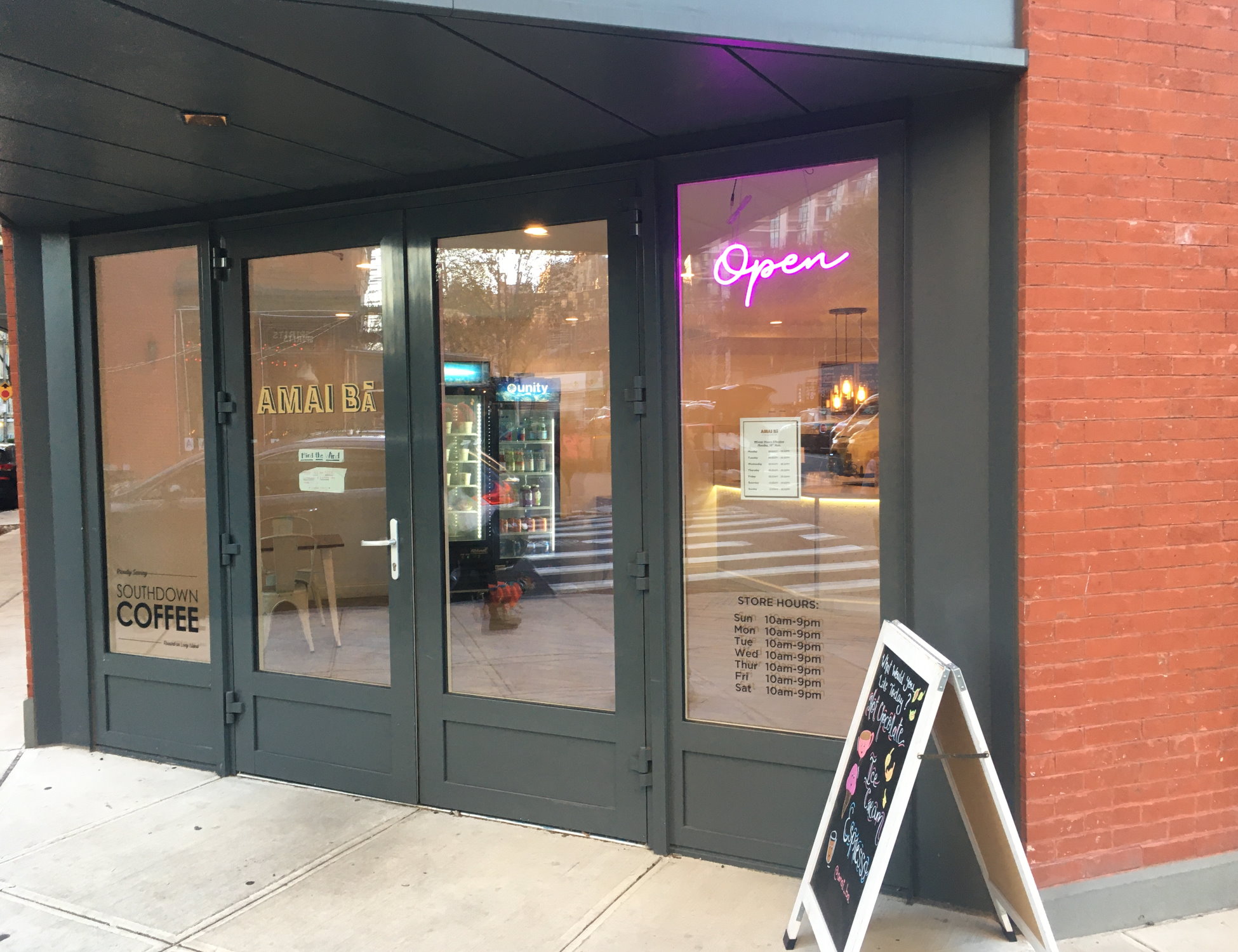
The website is https://www.xn–amaib-jwa.com. This was posted via QR code, taped to the shop window before the cafe opened. I’ve been hoping it would reappear on the permanent signage, but nothing so far – possibly because the website is still an empty placeholder.

Punycode https://www.xn–amaib-jwa.com is the agreed standard RFC 3492 way to encode https://www.amaibā.com. This is necessary because the Unicode character ā (a with macron, used mostly in rominisation of non-Latin writing systems) is not part of the letter/digit/hyphen character set supported by DNS, making amaibā.com an Internationalized domain name. Under the hood, xn–amaib-jwa.com is the “real” domain name, but most modern browsers are configured to show the site as amaibā.com.

Se hele indlægget

Sted: Brooklyn Heights, Brooklyn, Kings County, New York, United States

Using NYC Dept of Buildings Building Information Search, part 2

Skrevet af jmapb den 8 april 2022 på English Sidst opdateret den 29 maj 2023.

[continued from part 1]

Carrying on with my Brooklyn survey… In the Bushwick neighborhood, I’ve found another new building to map, and a good opportunity to show a little more of NYC’s Building Information Search tool (aka BIS.). Like last time, we’ll start by finding the building’s BIN and height using BIS’s search option 1, with borough Brooklyn, housenumber 618, and street Bushwick Avenue. Here’s the resulting Property Profile Overview page:

BIS Property Profile Overview of 618 Bushwick Avenue

(That exciting red bar means this development is currently in trouble with the Dept of Buildings, but that’s none of my business.) We find the BIN, 3425505. Note the “ALSO SEE OTHER BIN(S) BELOW” message and the “Additional BINs for Building” field – these are older obsolete BINs that this new building has supplanted. The “DOB Building Remarks” note about multiple lots being merged tells the same story, which is a very familiar one in Brooklyn: A large new building has replaced several smaller buildings.

Se hele indlægget

Sted: Bushwick, Brooklyn, Kings County, New York, 11237, United States

Using NYC Dept of Buildings Building Information Search, part 1

Skrevet af jmapb den 11 marts 2022 på English Sidst opdateret den 18 marts 2022.

To celebrate NYC Open Data Week, a brief introduction to the NYC Department of Buildings Building Information Search tool.

I’ve spotted a new building in Brooklyn that’s missing in OSM. My goal is to add this building to the map, keeping parity with New York City’s established tagging practices for buildings.

NYC had a full import of building footprints in 2013-2014. In addition to building=yes, all buildings were tagged with height (in meters) and nycdoitt:bin (the city’s Building Identification Number, or BIN for short). Buildings with only a single address were also tagged with addr:housenumber, addr:street, and addr:postcode. For buildings with multiple addresses, a node for each address was placed inside the building perimeter.

The building I found has just one address: 1021 Bedford Avenue, 11205. I’ve added the addr: tags, but I’d also like to know the height and BIN so this building will be as well-tagged as those around it. So let’s look it up in the Department of Buildings Building Information Search (BIS for short), which can be found at the following arcane url:

https://a810-bisweb.nyc.gov/bisweb/bispi00.jsp

Here’s the initial search form:

Se hele indlægget

Sted: Prospect Heights, Brooklyn, Kings County, New York, 11238, United States