OpenStreetMap logo OpenStreetMap

lxbarth's Diary

Recent diary entries

OpenStreetMap is published under a share-alike license, the so called Open Database License (ODbL). The license says that if raw OpenStreetMap data is mingled with raw third party data, and the result is used publicly, you are required to release the result under the same ODbL. This is, in short, the share-alike principle under which OpenStreetMap data is available today - under certain circumstances, it extends the license of OpenStreetMap data to data sets it’s mixed into.

Sounds like a great idea at first, right? You’re promoting the idea of opening data by making sure anyone who uses your data opens their data too. Well, there’s a big gotcha: we wind up more often with OpenStreetMap not being used rather than with previously closed data opened up. This in turn hurts the project which thrives on increased adoption.
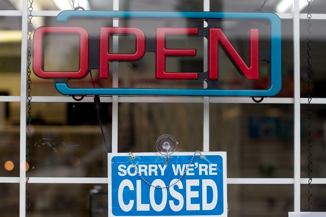
Photo: Alan Levine

See full entry

Share what you’ve been working on, or present your vision for OpenStreetMap at this year’s State of the Map US in Washington DC April 12 - 13.

You have until February 2nd (this Sunday) to submit your session.

You’ll find the submission form here: http://stateofthemap.us/

Looking forward to hearing from you.

Presentations at State of the Map US 2013. Photo: Justin Miller.

This is an update on the ongoing import of New York City buildings and addresses. For background read up on New York City and OpenStreetMap cooperating through Open Data

At our kick off session past month in New York City, we’ve discovered issues with the data conversion that are fixed now and the import is ready to start over again.

We have taken the time to take a close review of existing uploads. Here are some issues we’ve found that are worth highlighting as we restart the import.

  • Make sure every upload to OpenStreetMap completely validates and all critical warnings are resolved before you update.
  • Critical warnings are at least any warnings or errors that stem from
  • Buildings overlapping with buildings
  • Buildings overlapping with other features they cannot overlap with such as roads
  • Resolve not only buildings duplicate with existing buildings but also addresses duplicate with existing addresses
  • Merge point of interest information from existing nodes to new buildings when they clearly building-level such as schools, fire houses, super markets, etc.

To get started head over to the tasking manager carefully (re) read instructions and grab a task.

Make your life easier and get these JOSM styles for buildings and addresses by emacsen. They’ll allow you to see issues with the data better. Learn how to install them in JOSM docs.

If you have any questions, fire away here on the comment thread.

Location: Manhattan Community Board 3, Manhattan, New York County, New York, United States

On the imports list I recently raised the question on whether to tag addresses on buildings ways or not. Specifically, if there is only one address for a given building polygon, should the address tags sit on the building’s ways or should the address tags sit on a separate node within the building? Obviously, if there is more than one address per building, there is no other way but mapping them as nodes separate from the building way.

Eric Fischer just ran an analysis to figure out what is actually the current convention in OpenStreetMap. Here’s the short answer: addresses are tagged on building ways where possible. By a wide margin.

Read on for the numbers.

Address tagged on building ways (left) is the more common approach in OpenStreetMap versus address tagged on a separate node (right).

The rough numbers break down like this:

See full entry

Last Saturday we officially kicked off the NYC building and address import with a community session hosted by OSM-NYC and Public Labs at the Pfizer building in Brooklyn. The goal was to get the local NYC OSM community involved in this large data undertaking and at the same time harden our import process.

Over 20 people attended, and we knocked out 158 of the over 5000+ sub-tasks total. Both turn out and tasks accomplished were great and exceeded what I expected for a casual Saturday afternoon event.

progress-nyc

We’ve also discovered an address formatting issue and a geometry conversion issue that put the import on hold until they are addressed.

Working through this import we’re learning very interesting lessons:

See full entry

Location: Williamsburg, Brooklyn, Kings County, New York, 11249, United States

Because I love it.

Open data is changing the world. OpenStreetMap, as a true open data project of the commons, is proving its viability with continuously growing contributor numbers and expanding adoption. We’re well under way to replace what has been historically the realm of governments and proprietary-data companies with amazing open data that is not better because it’s cheaper, but actually provides fresher and more detailed data because it’s open and community driven. It’s exciting to be a part of this in my job as data lead at MapBox, as an individual contributor and as a board member of the OpenStreetMap US chapter.

This last year on the board of OpenStreetMap US has been amazing. Working together with Jim, John, Randy and Martijn on the board and with the great support of community members like Kathleen Danielson, Bonnie Bogle and Ian Dees, we’ve brought the organization to a new level. We’re honing in on our goal to not only promote OpenStreetMap in the United States, but to make it bigger, stronger and more diverse. Here are some of the things we’ve accomplished:

See full entry

A Social OpenStreetMap.org Without Groups

Posted by lxbarth on 24 September 2013 in English.

There has been lots of talk about groups on OpenStreetMap.org lately. In early 2013 Mikel called for better social tools, including groups on OpenStreetMap, and lately more often groups have been mentioned as a replacement for our ailing mailing lists. Saman had a version of groups in his blue sky mockups for OpenStreetMap.org. Tom’s posted a sketch for groups as pull request.

I’d like to add a dose of skepticism in this discussion: I don’t think we should implement groups on OpenStreetMap.org right now, there are better alternatives to get started with if our goal is to make OpenStreetMap more social and let mappers connect better.

Here’s why:

  1. Most conversations ideally don’t require groups.
  2. It’s hard to do social software right, groups in particular.
  3. Social media platforms are distributing.

(1) Most conversations ideally don’t require groups

See full entry

Finding out fast who’s modified the map is hugely valuable to review changes in areas you care about, to connect to new mappers or to just show how fresh the map is.

Unfortunately, the part of OpenStreetMap.org that’s supposed to provide this functionality - the history tab - is functionally broken. I’d like to suggest here a straightforward way to fix it, punting on some of the hard engineering problems that fast browsing of historic changes bring with them.

Background

To recap if you’re new to the issue, here’s why the history tab doesn’t work today: virtually anywhere in the world you’d like to see the latest changes of a particular area on OpenStreetMap, what you’ll actually get is large-scale changes whose bounding box happens to intersect with with the area on the map you’re viewing while not actually impacting any data in the area you’re viewing.

This is a well known problem in OpenStreetMap and people like Matt Amos, Ian Dees and more recently Paweł Paprota have worked on coming up with a solution for this issue.

The underlying engineering problem is Hard: changes to OpenStreetMap are organized in changesets, each one of which can contain up to 50,000 edits and whose modifications can be geographically huge. Querying all changesets that actually modified data in an arbitrary bounding box of the world and displaying them in reverse chronological order is computationally expensive while at the same time it should happen in milliseconds to satisfy a web request and allow for fast browsing.

Fixing the history tab

At the Chicago hack weekend Tom and I created a prototype that completely punts on the expensive problem of fast browsing for the entire changeset history. The approach we’ve taken is essentially to present you with a map and a list of the latest changes on visible elements first, then only reveal the history of an element when you click on it.

See full entry

LearnOSM Relaunched

Posted by lxbarth on 21 March 2013 in English.

We just relaunched LearnOSM - the step by step resource for learning OpenStreetMap. LearnOSM was launched in 2011 by the Humanitarian OpenStreetMap team for the workshops they are giving world wide. It has grown into a resource used by OpenStreetMap newcomers and trainers well beyond its roots in humanitarian aid and disaster risk management.

Read up on the new LearnOSM and learn how to contribute to translations and other improvements by Jue Yang, the designer and developer behind the new face of LearnOSM:

http://mapbox.com/blog/learnosm-with-new-design/

Spot checking the openstreetmap-carto style

Posted by lxbarth on 19 December 2012 in English.

Andy Allan recently ported the OpenStreetMap standard style from pure Mapnik XML to CartoCSS and TileMill. This is exciting as it’s a huge step towards making contributing to the style more accessible. The port is nearly perfect and kinks are being worked out right now. I took a minute to spot check and pull together a couple of screenshots showing just how close this awesome piece of work is. I hope to see this go up soon on OpenStreetMap.org. Andy’s port wouldn’t change anything about how tiles are being rendered on OpenStreetMap, all that changes is how the style for those styles would be created: In the future, we’d use TileMill and generate the Mapnik XML from user friendly Carto CSS.

Here is San Francisco in the new OSM-carto port, just looks like the existing map:

Setup

See full entry

Test driving iD

Posted by lxbarth on 14 December 2012 in English.

Stoked about test driving the great work of Tom, Richard, John, Saman and others on the new iD editor. Here’s a quick screenshot. You can get started yourself with iD fast, just clone the repo, point your browser to the index.html file in it and get started editing. Note that if you’d like to upload your changes to the test server, you’ll need an account on it. Report any bugs you’re finding on the issue queue.

We’re on the bus now heading back from New York City to Washington DC after an eventful week (read about the $575k Knight awarded Development Seed for OpenStreetMap work on the MapBox blog).

Here are some pictures of the OpenStreetMap intro workshop Ian and I held yesterday at foursquare’s headquarter’s. Thanks to the NYC OSM community leads Liz, Serge and Eric for the initiative and promotion.

Thanks to David Blackman of foursquare for kindly offering foursquare’s great digs in Manhattan for this workshop. Join the OSM NYC Meetup Group if you’d like to stay in the loop on all things mapping NYC.

A great crowd of about 30 people turned out for the workshop.

See full entry

Location: University Village, Manhattan, New York County, New York, 10012, United States

In Tokyo for State of the Map 2012

Posted by lxbarth on 29 August 2012 in English.

kkaefer, ajashton and myself will head to Tokyo for State of the Map.

We’ll arrive on Wednesday afternoon and head out on Monday afternoon. Hotel TBD. On Saturday, I’ll give a talk about how we’re improving OpenStreetMap with Foursquare.

I’m looking forward to meeting / seeing many great people. Drop me a line if you’d like to get in touch ahead of time.

Calle Tokio in Mexico City

Location: Komaba 4, Komaba, Meguro, Tokyo, Japan

Come out to the OSM introductory workshop in New York City on September 22nd 2012.

We’ll start form square one, with an intro to OSM and its data, learning JOSM, using OSM resources and more. This clearly targets new comers to OSM mapping, but if you’re a seasoned mapper, you should come out too. The NYC community is just reviving and there are lots of priorities to discuss and new people to meet. Of course, we should have drinks after (where TBD).

Find out all the details and sign up on the NYC OSM Meetup group.

Thanks to Liz Barry for organizing the event.

I am looking forward to see you there!

Location: Manhattan Community Board 5, Manhattan, New York County, New York, United States

For documentation’s sake: a couple of pictures from OSM workshops in Rio de Janeiro’s Cidade de Deus and Complexo do Alemão with Ônibus Hacker, around the Rio+20 Conference for Sustainable Development in June.

Cidade de Deus - street signs

Cidade de Deus - jotting down location and name of points of interest

See full entry

Location: Cidade de Deus, Rio de Janeiro, Região Geográfica Imediata do Rio de Janeiro, Região Metropolitana do Rio de Janeiro, Região Geográfica Intermediária do Rio de Janeiro, Rio de Janeiro, Southeast Region, Brazil

The American Red Cross and Humanitarian OpenStreetMap Team called on Volunteers to Map the Ugandan Cities Gulu and Lira on World Humanitarian Day

Mapping at the American Red Cross Headquarters yesterday. On the screen a video message from the team in Uganda.

A good two dozen mappers followed HOT’s and ARC’s call to help map Gulu and Lira as an effort to improve maps for fire fighters and rescue teams.

GeoEye has provided improved satellite imagery that State Department helped process and host for the event. About two dozen volunteers helped trace roads, tracks, buildings and huts from imagery. As a next step the American Red Cross will send a team of trainers to Uganda to initiate necessary ground surveys verifying tracing work and to teach Quantum GIS skills for using OSM data.

You can still join the effort by picking up tasks from one of the two HOT OSM Tasking manager jobs:

See full entry

Location: Foggy Bottom, Ward 2, Washington, District of Columbia, United States

Después del Taller de OSM en Mexico DF - Wrapping Up and Next Steps

Posted by lxbarth on 13 August 2012 in Spanish (Español). Last updated on 14 August 2012.

(English further down)

Gracias a todos por atender al taller de OpenStreetMap Mexico DF el viernes y el sabado pasado. Huracán Ernesto hizo que nos quedamos adentro, pero de hecho eso fue excelente, como así pudimos enfocarnos de manera muy profunda en las herramientas de OpenStreetMap.

Ahora, mantengamos el impulso! Como resultado del evento Vitor George abrió una lista de correo para México: talk-mx, suscríbete aquí para mantenerte en contacto! Planificamos unos talleres parecidos alrededor de Desarrollando Latinoamerica que tendrá lugar en varios ciudades Latinoamericanos el 1 y 2 de Diciembre. Mandame un mensaje si estás interesado en ayudar a organizar, impartir, programar o diseñar.

Muchas gracias a Telmex Hub por equipo, lugar y promoción el evento. Tanto a nuestros amigos del Citivox, SocialTic y Fundar que hicieron posible este evento.

Aquí algunas fotos, una lista de enlaces y temas de los cuales hablamos y algunos usuarios que atendieron. También veanse estas fotos de fotografía aerea del domingo en el Chapultepec.

Hasta muy pronto!

English

Thanks everyone for coming out to the Mexico City OpenStreetMap workshops on Friday and Saturday. The fact that Hurricane Ernesto kept us inside I think was a good thing as it allowed us to do a great deep dive into doing OpenStreetMap work.

Let’s keep the momentum going now, as a result of the event, Vitor George has initiated the talk-mx list, I encourage you to sign up! We’re planning on similar OpenStreetMap workshops around Desarrollando Latinoamerica on December 1st and 2nd, please get in touch if you are interested in organizing, teaching, promoting, designing or programming for this event.

A big thanks goes to Telmex Hub for hosting the workshop and promotion and to our friends and partners at Citivox, SocialTic and Fundar for promoting this event.

See full entry

Location: Centro, Ciudad de México, Cuauhtémoc, Ciudad de México, 06000, México

Balloon Mapping Mexico City

Posted by lxbarth on 13 August 2012 in Spanish (Español).

Este domingo salimos al Bosque de Chapultepec para volar un globo del excelente Balloon Mapping Kit del Public Laboratory. Encuentra aquí una pequeña historia de fotos de este día. La idea era de sacar fotos aereas, no fue tan exitoso como nos hubiera gustado…

Haz click en las fotos para ver más información.

This Sunday we went to Chapultepec park to fly a balloon (using the excellent [Balloon Mapping Kit of Public Laboratory. See here a pictures of the day. The idea was to create areal imagery, it didn’t quite work out that way…

Click on pictures for more info.

See full entry

Location: 1a. Sección del Bosque de Chapultepec, Ciudad de México, Miguel Hidalgo, Ciudad de México, 11100, México

Taller OSM Mexico DF Agosto 2012

Posted by lxbarth on 9 August 2012 in English.

Eric and myself will be leading a MapBox training and OpenStreetMap mapping party in Mexico City tomorrow, Friday (10) and Saturday (11). On both days we will meet at the Telmex Hub in the center of Mexico City. You can find all the details on our blog.

In preparation, I’ve done some research in areas of Mexico DF we could be focussing on. The weather might not be cooperating, scroll to the bottom to see our plan for if we’re stuck with rain.

Ground surveys

Here are a lot of areas in Mexico DF that we could survey with Walking Papers and GPS. I’ve pulled a bunch of them together based on what I see missing on the DF map, not knowing these areas myself. Let’s pick ones that are busy and safe enough. Please add more where you see fit.

We should also figure out whether we can/should get bikes or cars for the survey.

(Click to go to see map on openstreetmap.org)

Around La Raza

Around Camarones station

See full entry

Location: Centro, Mexico City, Cuauhtémoc, Mexico City, 06000, Mexico