OpenStreetMap logo OpenStreetMap

malenki's Diary

Recent diary entries

Weihnachtseinkäufe für OSM

Posted by malenki on 27 November 2015 in German (Deutsch).

Pünktlich zum Beginn des alljährlichen Jahresend-Kaufrausches ziehe ich wieder ein Fazit zum Stand des Amazon.de-Werbepartner-Programms für OpenStreetMap.

Seit Beginn der Teilnahme an dem Programm wurden bis heute (27.11.2015) über das Amazon-Partnerprogramm 6178 Produkte gekauft, was in einem Umsatz von 174.605,76 EUR für Amazon resultierte.
Die Auszahlungen für OSM summieren sich auf 8.065,74 EUR, mit dem noch auszuzahlenden Beträgen wird eine Summe von 8.723,71 EUR erreicht. (Amazon zahlt den Werbepartner-Anteil drei Monate nach Generierung aus, um Rücksendungen ausnehmen zu können.)

Falls ihr im Dezember noch die eine oder andere Anschaffung tätigen wollt und bei Amazon einkauft, benutzt bitte den Affiliate-Link für Amazon.de oder installiert in Firefox die Amazon-Suchmaschine mit Affiliate-Link, die ihr auf der Spenden-Seite finden könnt. Auch für die Partner-Links für Amazon.co.uk oder Amazon.com gibt es dort entsprechende Suchmaschinen.

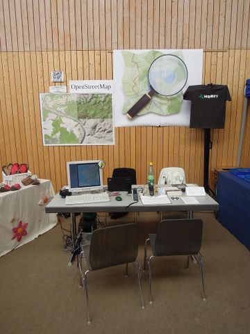
Die Auszahlungen von Amazon.de gehen an den FOSSGIS e.V., der in Deutschland die Interessen von OSM vertritt. Ich durfte bereits zweimal die Unterstützung des FOSSGIS genießen – bei der Anschaffung einer Leinwand für OSM-Stände und kürzlich *hust* bei der Erstattung von Übernachtungskosten, während ich drei Tage einen OSM-Stand betreute.
Jeder – auch jedes Nicht-Mitglied – kann beim FOSSGIS um Förderung von OSM-bezogenen Projekten und auch anderen, den Zielen des Vereins entsprechenden Projekten bitten. Details dazu und eine Liste von Projekten, die der FOSSGIS bereits finanziert hat, findet man in dessen Wiki. (Ich selbst bin auch (noch?) kein Mitglied des FOSSGIS.)

Vielen Dank an alle, die OSM direkt oder indirekt gespendet haben.
Weiterhin Frohes Mappen!

Shopping for OSM

Posted by malenki on 27 November 2015 in English.

Just in time before the annually shopping month starts I want to present the state of the German Amazon Affiliate Program.

Since I started the Affiliate Program at Amazon.de for OSM 6178 products got purchased which resulted as of today (27.11.2015) in Amazon sales of 174.605,76 EUR. The fees transferred to OSM amount to 8.065,74 EUR, with fees still to be paid they sum up to 8.723,71 EUR. (Amazon pays the fee three months after generating because of probable returns.)

So if you purchase the one or other thing in December and consider shopping at Amazon please use the Affiliate link for Amazon.de, Amazon.co.uk or Amazon.com – depending on where you shop. If you want to install an Amazon search engine in Firefox with that link you can do so at the German OSM donation page.

The fees from Amazon.de are transferred to the FOSSGIS e.V. the contact of OSM in Germany.
Two times I myself got helped by the FOSSGIS – as I purchased a canvas for OSM booths and lately *cough* a refund of expenses for overnight accommodation while managing an OSM booth for three days. In the FOSSGIS wiki you can ask for funding for your project if it is related to OSM (or if it matches the association’s goals) and also see a list of already funded projects. Everybody – also when not being a member – can ask the FOSSGIS for funding OSM related Projects. I myself (still?) am not member of it.

Thus said, I want to thank everybody who donated directly or indirectly to OSM.
Happy Mapping!

Nachtrag 5. Abenteuertage Glauchau

Posted by malenki on 26 November 2015 in German (Deutsch).

Vom dritten bis zum fünften März hatte ich mit Rockus bei den Abenteuertagen einen OSM-Stand betreut. Kürzlich fiel mir die Quittung für die zwei Übernachtungen in die Hand. Im April meinte jemand, der mit dem FOSSGIS recht vertraut schien, ich solle den Beleg doch einschicken. Auch mit nachträglichen Anfragen gehe man durchaus kulant um. Obwohl mittlerweile acht Monate vergangen waren, schickte ich den Beleg ein.
Und siehe da – die Kosten wurden mir schneller erstattet als gedacht.
Vielen Dank! :)

[OSM-Stand] (osm.wiki/File:5.Abenteuertage_Glauchau-_OSM-Stand.jpg)

Location: Glauchau, Zwickau, Sachsen, 08371, Deutschland

easy undelete of several ways

Posted by malenki on 18 November 2015 in English. Last updated on 9 April 2016.

Second tought on my older posting about partially deleting changesets. Again, it is also a note-to-self.
Only helpful, if you have a bash with the usual tools at hand. For Windows there is Cygwin providing these.
You need a JOSM with the undelete plugin installed.

deleted objects of a changeset Example-Changeset with deleted objects and some of them selected for copying

If you stumble over a huge changeset and only want to undelete the deleted ways in that changeset without a time consuming revert of the whole changeset proceed this way:

See full entry

bot user accounts

Posted by malenki on 7 November 2015 in English. Last updated on 9 November 2015.

Just a list of the 240 user names newly registered at OSM from midnight to 02:40. (Here is the raw data.) Looking at it it seems obvious OSM needs a more script and bot proof registration process. The only problem: Who’s gonna write it?
Edit: I had collected 5130 user accounts registered during ~46 hours of which about 50% seem to be users registered by bots/scripts.
Edit II: I created a related issue at github.

See full entry

5. Abenteuertage in Glauchau

Posted by malenki on 12 March 2015 in German (Deutsch). Last updated on 13 December 2015.

[OSM booth] (osm.wiki/File:5.Abenteuertage_Glauchau-_OSM-Stand.jpg)

Auf den AbenteuerTagen durfte ich vor zwei Jahren als Gegenleistung für einen GPS-Workshop OpenStreetMap mit einem Stand repräsentieren. Letztes Jahr lud mich Gil Bretschneider als der Veranstalter zu den nun fünften Abenteuertagen ein, OSM zu vertreten. Dankbar nahm ich die Einladung an, auch wenn ich mir kurz vorm Festival den rechten Arm angebrochen hatte.

Das Festival war wieder sehr gut organisiert, alles klappte reibungslos. Auch abseits vom OSM-Stand traf man viele interessante Leute. Diesmal nahm ich mir die Freiheit, einen der Vorträge zu besuchen: Mongolei – Mit Kind & Kamel unterwegs im Nomadenland. Er war faszinierend, aber wie immer bei solchen Gelegenheiten möchte ich eigentlich nicht den Vortrag über die Reise hören, sondern sie selbst unternehmen…

See full entry

Location: Glauchau, Zwickau, Sachsen, 08371, Deutschland

5th Adventure Days in Glauchau

Posted by malenki on 12 March 2015 in English. Last updated on 13 December 2015.

OSM booth OSM booth

At the AbenteuerTage (Adventure Days, a festival where adventurers present their travels) two years ago in exchange for hosting a GPS Workshop I was allowed to represent OpenStreetMap. Last year Gil Bretschneider, operator of the festival, invited me again to have an OSM booth at the festival last weekend. Happily I agreed, although I partly broke my right arm shortly before the beginning.

Again the festival was well organised, everything ran smoothly. Of course one could also meet interesting people when not being at the OSM booth. :)
This time I was so bold to visit one of the presentations of a family with two girls of now eight and four which had travelled Mongolia during three years for about ten months with camels. Although I am of course fascinated by this kind of reports I’d prefer not to listen to the traveller but instead do the travelling on my own.

See full entry

Location: Glauchau, Zwickau, Saxony, 08371, Germany

Just realised that the steles forming the Memorial to the Murdered Jews of Europe don’t have the correct size. Though I salute to the mapper who mapped the memorial: is there someone who can give the steles their true size? Regarding to wikipedia they are 2.38m to 0.95m (with different height values).
I created one with the exact measures but think that it takes a little more to create all of them in file.

Location: Mitte, Berlin, Germany

A look at Scout Signs

Posted by malenki on 3 January 2015 in English.

Here the email I just sent to Scout/Skobbler:

Hi,

I’ve had a look at Scout Signs. I agree that this is a comfortable way to collect maxspeed data. What I’ve compared in my region leads me to the following conclusions:

  • the average Scout Sign I verified is misplaced by averagely 20 m¹
  • all of the speed limits shown by Scout Sign I verified were already mapped in OSM
    –> I’d find it helpful to only show signs in JOSM for highways without maxspeed=* or maxspeed:forward/backward or where the by Scout collected maxspeed doesn’t match the one on the highway
    –> because: after closing a lot of Scout Signs with “it is already in OSM since 1-4 years” the task gets boring
  • the OCR seems not to be failsafe: alt text (Sign ID 25587, here)

See full entry

partially undelete changesets

Posted by malenki on 26 December 2014 in English. Last updated on 18 November 2015.

A note to self but may also be helpful for other mappers.

Edit: The newer easy undelete of several ways may prove faster results with less work.

Recently I had to undelete a lot of stuff. I used JOSM with enabled remote control, the Plugins todo and reverter on Linux and established this workflow:

  • Find a changeset which looks a bit fishy. For example if the user seems quite inexperienced (short time OSM member, small amount of changesets) and has a lot of deleted objects on a changeset this seems worth a second look. Example-Changeset, deleted objects are shown like this¹:
    deleted objects of a changeset

  • Revert that changeset locally in JOSM using the revert plugin: press ctrl-t, enter the changeset number and click “revert”

Since we don’t want to revert the whole changeset – maybe there are some useful edits in it, too – we need to take some extra steps:

See full entry

6000 EUR for OpenStreetMap

Posted by malenki on 13 December 2014 in English.

OSM affiliates amazon.de revenue with month of generation (pay-out two months later)

A small summary

Matching the end-of-year rallies for donations of a lot of institutions I want to have my little share in pointing the people to OpenStreetMap as receiver.

In 2011 I set up an affiliate account for OSM at Amazon.de. Since then a lot of people used the affiliate link to buy their stuff –4315 products– at Amazon so that we had a steady flow of averagely 140 EUR per month. Now for the headline I used: In this very month the 6000 EUR mark will be hit. With the beginning of the new year OSM will have received in total 6.021,25EUR. All numbers in full detail you find at the wiki.

In the name of OpenStreetMap I want to thank everybody who contributed to this sum. Of course I also want to encourage you to continue doing so! ;)

Have some relaxed holidays –
Thomas

6000 EUR für OpenStreetMap

Posted by malenki on 13 December 2014 in German (Deutsch).

OSM affiliates amazon.de Affiliate mit Monat der Erzeugung (Auszahlung 2 Monate später)

Ein kleiner Rückblick

Passend zu den Jahresend-Spendenmarathons aller möglichen Institutionen möchte ich meinen kleinen Teil dazu beitragen, auf OpenStreetMap als Empfänger hinzuweisen.

2011 richtete ich für OSM einen Werbepartner-Account bei Amazon ein. Seitdem haben eine Menge Leute den dazugehörigen Affiliate-Link verwendet, um bei Amazon 4315 Produkte einzukaufen, so dass durchschnittlich 140 EUR pro Monat zustande kamen.
Nun zur Überschrift: In diesem Monat wird die Summe der Auszahlungen die 6000-EUR-Marke überschreiten. Insgesamt wird Amazon zum Jahreswechsel 6.021,25 EUR an OSM überwiesen haben. Detaillierte Zahlen finden sich im Wiki.

Im Namen von OpenStreetMap möchte ich jedem danken, der zu dieser Summe beitrug. Natürlich möchte ich dazu ermuntern, das auch weiterhin zu tun.

Entspannte Feiertage wünschend –
Thomas

Hiking with Mapillary – aftermath

Posted by malenki on 2 October 2014 in English. Last updated on 6 September 2015.

View from Mt. Valamarës Part of a 360° panorama from Mt. Valamarës. Click to see all of it in good quality.

During four weeks of which I hiked about three I used mapillary as described in a previous blog post.
The result were 113.384 pictures with 596 GB size (on ext4 – on exfat it was 623 GB).
The maximum of pictures recorded during a day was 9000, the average per day 4500.
After review 101.261 pictures with 561 GB size (ext4) remained.

Hardware used (lent from the Mapillary company):

  • 2x 128 GB microSD card
  • 2x deltaco Powerbank 10 Ah
  • 2x short cables USB-A–µUSB- ~20 cm
  • 1x long cable USB-A–µUSB- ~100 cm
  • 1x Sony Xperia Z1 Compact (w/o SIM card)
  • 1x external 2,5” USB 3.0 drive 2TB
  • 1x OTG-Ycable (purchased on my own)
  • Anker 40W charging station (Amazon OSM affiliate link) with 5xUSB with 2A output each. My property, can really recommend it.

See full entry

Location: Gjerë, Poroçan, Bashkia Gramsh, Elbasan County, Central Albania, 3308, Albania

Hiking with Mapillary

Posted by malenki on 29 July 2014 in English. Last updated on 6 April 2016.

Like last year I plan to have a walk in Albania during my holidays.¹ The planned route is this. Valley between mountains Dhëmbel and Nemërçka ## Hardware

Though the mobile phones I use are Siemens ME45 I already had had contact with Peter Neubauer from Mapillary now and then and also heard him on Radio OSM (German OSM podcast #31). So I asked him about recommended hardware to run the Mapillary app for some days far away from civilisation and power sources and to store away the lots of images created.

Calculations

In walking mode the Mapillary app is set to make a picture every two seconds as default AFAIK. After having had a first walk with Mapillary this seems to be a reasonable choice. Since my average day trip lasts up to eight hours and I assumedly will hike on 18 days I calculated the following:

pictures/minute x 60 minutes x 8 hours x 18 days x picture size 5 MB = assumed amount of created data
30 x 60 x 8 x 18 x 5 = 1.296.000 MB

Stuff

See full entry

Smartphone mounts

Posted by malenki on 28 July 2014 in English. Last updated on 29 July 2014.

Since I got borrowed a Smartphone from Mapillary (more about that soon) but no mounts for car nor anything, I had to make up some. As I needed one for the car I had nothing usable with me than an old T-Shirt which was dedicated for cleaning purposes. I just ripped a strip from it – et violá: Handyhalterung fürs Auto lowest cost smartphone mount ever
A sequence recorded this way

A mount for walking was not as easy to create. I purchased what seemed to be a durable smartphone cover for about 8 EUR and a 30 cm long strip of 5 cm wide hook-and-loop fastener for ~1,50 EUR.

See full entry

1001 messages

Posted by malenki on 8 June 2014 in German (Deutsch).

Today I exceeded the number of 1000 sent messages: 1001 OSM messages

The number of received messages is 618.

Maybe others have sent more messages but in the beginning

  • I was nearly the only active mapper in my region;
  • there were little QA Tools (or I did not know them) and
  • I had a lot work in my region so I had no as much time as now to bother other users. :)
Location: Lami i Madh, Derjan, Bashkia Mat, Qark Dibra, 8010, Albanien

Wanderreise mit OpenStreetMap – in Albanien

Posted by malenki on 2 May 2014 in German (Deutsch). Last updated on 29 July 2014.

Zu meiner Wanderung durch Albanien, die auch Grundlage für den Wanderreise-Vortrag bei den Linuxtagen war, gibt es nun detaillierte Berichte, Karten, Höhenmeterangaben und Fotos en masse.
Wer sich etwas Zeit mit der Lektüre oder dem Betrachten der Bilder vertreiben möchte: hier entlang.
Einige Bilder sind bei Wikimedia Commons besser aufgehoben.

Valley between mountains Dhëmbel and Nemërçka

Hochtal zwischen Dhëmbel- und Nemërçka by malenki; CC-by-SA 3.0

Location: Sheper, Zagorie, Bashkia Libohovë, Qark Gjirokastra, Albanien