Suaicheantas OpenStreetMap OpenStreetMap

An leabhar-latha aig maning

Clàran an leabhair-latha o chionn goirid

OpenStreetMap Philippines 2020

Air a phostadh le maning 25 Am Faoilleach 2021 sa chànan English

osmph-2020-montage

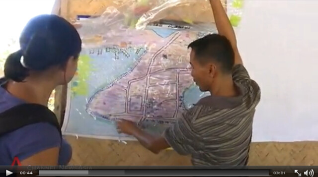
The pandemic changed the OSM-PH community plans for the year in 2020. In person meetups became online and we had to adjust our big plans for this new approach. I collected the publication materials we posted in our social media account to get a broad sense of what we did last year.

The montage above is a small collection of them. Some highlights.

See full entry

Àite: Amihanan, Navotas, Cardona, Rizal, Calabarzon, 1950, Philippines

Taking community diversity and inclusion to the center stage

Air a phostadh le maning 18 An t-Sultain 2020 sa chànan English Last updated on 21 An t-Sultain 2020.

At OpenStreetMap related conferences, I always look forward to the technical talks so that I can learn and improve my mapping skills. Equally important are the community building talks, this gives me great perspective on how mapping communities are nurtured around the world especially for countries whom I share the local context and culture.

For a crowdsourcing online community like us, however, community stories are often relegated as side tracks or lightning talks in a smaller room. If we truly believe that the strength of OSM is the community, these stories should be front and center in our interactions especially during conferences.

This is what we tried to do within our own community events. Here are two events I helped co-organized that is aimed at increasing the audience listening to our community stories.

State of the [country] talks are plenary sessions in the State of the Map Asia in 2016.

We decided that all country status reports at SoTM-Asia in 2016 will be reported to the plenary. This ensures that everyone hear and learn how each country are building their own community.

See full entry

way/445712235/extended_history

Air a phostadh le maning 3 An t-Sultain 2020 sa chànan English

This is OSM way/445712235. It was edited twice and has 9 nodes and 2 tags.

Screen Shot 2020-08-25 at 11 32 33

way/445712235 was created together with fisherfolks, its local government unit, a social action arm of a university, researchers and diving enthusiasts in Lian, Batangas. It was a culmination of years of grassroots organizing, research and community-based participatory mapping I was part of as a volunteer.

COSCA as the social action arm of the De La Salle University is working with the local fishing community in Kay Reyna (Lian, Batangas) through its community-based resource management program. Part of the community’s aspiration is to establish a community managed marine protected area (MPA) to protect and rehabilitate their marine ecosystem. During the summer of 2012, I was asked by friends to help in mapping Kay Reyna’s community-managed MPA.

My task is “simple”, grab a GPS and mark the location on the boundaries of the proposed MPA.

Community process for establishing the MPA

See full entry

Àite: Newport Hills, Lumaniag, Lian, Batangas, Calabarzon, 4216, Philippines

HOT Board Candidate Statement 2020

Air a phostadh le maning 19 An t-Iuchar 2020 sa chànan English Last updated on 24 An t-Sultain 2020.

Update: I was not elected in the previous election. HOT is doing another round this year, to fill-in for the remainder of the term of one borad member who resigned. I’m putting myself forward again. This diary will again serve as my statement.

👋🏾 This is Maning from the Philippines and I’m running for the HOT board election this year. I am a long time OpenStreetMap contributor focusing mostly in building the open mapping community in my country and in Asia.

Over the years, I have been working and living with marginalized sectors such as indigenous peoples, fishefolks, upland farmers and, urban poor communities. In most of these communities, the common struggle is always tied to a place or resource. The understanding of place is a powerful platform that enables conversation between those in the margins and those in power to negotiate and work together. This is the reason I focused my work to using geospatial technology for social justice and conservation. I believe OpenStreetMap and to an extent, HOT as an intermediary is powerful and can effect social change.

I believe my experience with working with marginalized sectors, open data/technology and building online communities in the Philippines can provide a unique perspective to the new challenges of HOT as an organization. However, I recognize that I lack the depth and experience, because I’ve never been a board member of an international organization.

To understand how HOT board operates, I talked to a number of people directly involved in HOT in the last few days. The conversations were insightful and gave me a good perspective on what I should care as a board member. Below is a distillation of these conversations and my personal opinion of what the organization should care about.

See full entry

Extracting building height from drone imagery

Air a phostadh le maning 26 An Lùnastal 2019 sa chànan English Last updated on 27 An Lùnastal 2019.

I experimented with extracting the heights values from the drone imagery and add them to the building polygons traced in OpenStreetMap. Read along if you want to understand the process or just go here to see it in action here!

3d 
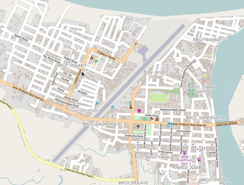
3D buildings around Foundation University, Dumaguete

Day 3 of Pista ng Mapa last Aug 3, 2019 was a series of field mapping activities. A couple of people did on the ground survey with field papers and mapillary. Our resident drone Mapher Leigh deployed her DJI Phantom 4 to survey the event venue and its surrounding community. Leigh uploaded all the drone derived data into OpenAerialMap including the elevation models! Using QGIS 3.6, I decided to explore ways to extract the heights from the derived DSM/DTM and use it for visualizing building polygons from OpenSteetMap.

For this exploration I used QGIS 3.6 with the GRASS GIS, Profile tool and QGIS2threejs plugin.

Downloading the drone derived layers from OpenAerialMap

See full entry

Àite: Taclobo, Dumaguete, Negros Oriental, Negros Island Region, Philippines

Lupang Arenda drone mapping - part 1

Air a phostadh le maning 8 An t-Iuchar 2019 sa chànan English Last updated on 9 An t-Iuchar 2019.

Last weekend, a couple of OSM volunteers and drone enthusiasts visited Lupang Arenda in Taytay, Rizal. The visit was part of the ongoing collaboration with Barangay Santa Ana in Taytay to use OpenStreetMap as one of their tools for managing community initiatives. The origins of this collaboration has an interesting back story but I won’t talk about it on this post. ;)

The main goal of the visit is to capture images using drones to create an updated aerial imagery of the community to identify individual building/houses. For a densely populated community like Lupang Arenda, it is difficult to get this level of detail using satellite imagery.


The crew. Photo by Erwin Olario.

See full entry

Àite: Santa Ana, Taytay, Rizal, Calabarzon, 1920, Philippines

A couple of weeks back, I was aimlessly panning around the Philippines in the OSM.org website and saw Banton island right at the center of the archipelago north of the Sibuyan Sea. I loaded the data in JOSM to check what was actually mapped in the island. It looks like it has decent coverage for roads and very few buildings. So I started adding a few buildings here and there and then it struck me, what would it take to systematically map the whole island remotely?


Banton Island in Romblon as viewed from a pump boat arriving from Marinduque. Photo credit: Lawrence Ruiz, Wikimedia Commons

This quest has begun …

Choosing the imagery

First, I checked if there are good imagery available other than Bing, I found that DigitalGlobe (DG) Premium and Standard looks more recent compared to Bing. Some areas are cloudy in Premium while clear in Standard and vice versa. I figured I can interchange these two depending on where I am mapping.

See full entry

Àite: Apayang, Hambi-an, Banton, Romblon, Mimaropa, 5515, Philippines

My Mapillary Trips

Air a phostadh le maning 17 An t-Ògmhios 2019 sa chànan English

I’ve been collecting geo-referenced photos since I started contributing to OpenStreetMap. When I discovered Mapillary a few years ago, I decided to upload these photos so that other people can use them in their own mapping.

grafitti
Street art in Marikina’s freedom wall

Here’s a few sequence I found interesting to revisit whenever I go to the Mapillary website (links to each sequence are included for viewing the high-res photos). They are categorized according to the mode of travel.

☑️ 🚶

See full entry

Data preparation for feature detection with Robosat

Air a phostadh le maning 22 An t-Iuchar 2018 sa chànan English

blend
Building detection at Villa Imelda, MacArthur.

For the last couple of weekends I’ve been tinkering with Robosat to detect features from aerial imagery. At its core RoboSat is using state of the art fully convolutional neural network architectures for semantic segmentation.

Daniel posted an excellent walk-through to run the RoboSat pipeline on openly available drone imagery in Tanzania.

This post follows Daniel’s guide for detecting buildings in drone imagery in the Philippines. The goal of this exercise is for me to understand the basics of the pipeline and find ways to use the tool in identifying remote settlements from high resolution imagery (i.e drones). I’m not aiming for pixel-perfect detection (i.e precise geometry of the building). My main question is whether it can help direct a human mapper focus on specific areas in the imagery to map in OpenStreetMap.

See full entry

Àite: Danao, Javier, 5th District, Leyte, Eastern Visayas, 6511, Philippines

Nodes in Asian cities in the last 10 years

Air a phostadh le maning 29 An t-Sultain 2016 sa chànan English

Intrigued by Alan McConchie’s presentation on OpenStreetMap past(s), OpenStreetMap future(s), I took a stab at looking at several cities in Asia using a similar approach at charting nodes creation and modification. In his talk, Alan gave a portrayed an ideal scenario where the data is constantly-maintained reaching a state of singularity. Are we seeing any of this trend in Asia?

The only non-Asian city I included is Berlin, Germany (in thick grey). This will be my benchmark as it is widely known that the German community is one of the most active in our community. I intentionally won’t draw specific conclusion to any of the city listed here. Each community is unique and deserves an in-depth look on its own but, I am posting questions that interest me by looking at the charts. Of course, everyone is welcome to share their own insight in the comments!

Cumulative nodes created and edited in the last 10 years

all_nodes_year

See full entry

Passive data for OSMing

Air a phostadh le maning 1 An t-Sultain 2015 sa chànan English

The idea of using passive data into OpenStreetMap is not new. Even during the early days of OSM, this concept was already discussed. What I mean by passive here are data sources that is not originally intended for use in OSM. This usually comes from third party services which gave permission to use their data into OSM. We are getting more of this recently and has helped me in improving my own mapping patch.

Animation below shows data from OSM public traces[0], Strava and Mapillary[1]. Marikina

However, I don’t think the idea of purely using passive data (where automatic data correction and update is done) will be possible in OSM. User input will always be needed.

[0] OSM public traces does not really qualify as passive data since many of them were uploaded for the purpose of mapping. However, I’ve seen many tracks in the Philippines that were uploaded and was not edited by the original user who uploaded the it.

See full entry

Disclaimer: This is specific to the Philippines, not a general OSM issue.

One of the most difficult data to collect in OSM are administrative boundaries (admin_level=*). It defies the on-the-ground rule. One cannot just go out and start surveying admin boundaries with a GPS. On the other hand, we see the importance of having admin boundaries in our database. We can define town/city limits. It improves geocoding. The maps looks nice. Humanitarians need them because they can plan and allocate resources according to administrative jurisdictions during a crisis. The only logical way to have this in OSM is to get them from various sources and do an import.

The most comprehensive source we found for the Philippines is from the freely available GADM. This website has a comprehensive collection administrative boundary data for free down to the smallest administrative units for many countries including the Philippines. Over the years, I tried to track down the provenance of GADM’s PH data. My geo-forensic skills lead me to people saying that the PH dataset originated from our national mapping agency. So, it seems very authoritative, why don’t we just import them? I say NO and here’s why (again, I am pertaining here to the Ph situation, GADM data maybe good in other countries and I have the utmost respect to the maintainers of the site sharing this to the public).

The license is incompatible. Period. End of discussion. Eugene discussed this years ago in our mailinglist.

Even if the license is compatible, the data quality is REALLY bad. Again, from Eugene’s mail to the list, here’s screenshot comparing OSM and GADM boundaries in Quezon City.

See full entry

Àite: San Diego, Poblacion District 9, Burauen, 2nd District, Leyte, Eastern Visayas, 6516, Philippines

Mapping Party in Butuan, Agusan del Norte

Air a phostadh le maning 10 An Lùnastal 2015 sa chànan English Last updated on 11 An Lùnastal 2015.

Last July 24-25, we had the third leg of the series of crowdmapping events co-organized by The Asia Foundation (TAF) and its local partners in Butuan City. The first was in lloilo and the second in Tagbilaran. Similar to the previous events, the objective of this mapping party is to increase awareness of the potential of using OpenStreetMap to complement the various mapping initiatives of the TAF’s local partners in the region by inviting mapper volunteers to participate.

butuan mappers

Butuan is a special place for me. I have never been to this part of Mindanao, but, this is where the journey of my relatives may have started when my grandfather and his family migrated from Luzon and started a new life to what was then called the “new frontier” of the Philippines 4 decades ago.

See full entry

Àite: Barangay 12, Poblacion, Datu Silongan, Butuan, Caraga, 8600, Philippines

Mapping Party in Tagbilaran, Bohol

Air a phostadh le maning 21 An t-Iuchar 2015 sa chànan English

Once again, we had another mapping event. This time, in Tagbilaran City, Bohol. This is part of the series of crowdmapping events co-organized by The Asia Foundation and its local partners. The first was in Iloilo City last May 2015.

Tagbilaran mappers

During the event, Bohol Governor Edgardo Chatto welcomed all the mappers and expressed his support to implement this initiative for the whole province of Bohol.

Bohol’s major income is tourism. However, when the 7.2 earthquake hit the island in 2013, the tourism industry was heavily affected. On the other hand, judging by the number of tourists (local and foreign) who was with me during the flight, I think tourism is now recovering. What a better way to help by providing a good map not only for the tourists but also for the local community!

The local partner of The Asia Foundation is the local chamber of commerce. Naturally, we focused on collecting business and tourism related map data during the field exercise.

See full entry

Àite: Poblacion 3, Tagbilaran, Bohol, Central Visayas, 6390, Philippines

Mapping Party in Iloilo City

Air a phostadh le maning 11 An t-Ògmhios 2015 sa chànan English Last updated on 21 An t-Iuchar 2015.

group photo

Last May 2015, I joined a mapping party in Iloilo co-organized by The Asia Foundation and several bike groups (IPAD Xtr, ICYC, iFOLD, Augustinian Cyclists) in the city. Originally, we designed to have an editing session using iD. But since most of them did not bring laptops, (they went to the meetup venue mostly on bikes of course!), we focused mapping using SmartPhones installed with OSMAnd.

See full entry

Àite: San Rafael, Mandurriao, Calubihan, Iloilo City, Western Visayas, 5000, Philippines

Continuing OSM-PH's DRR Mapping with local communities

Air a phostadh le maning 10 An t-Ògmhios 2015 sa chànan English

One of the on-going initiatives by the local OSM Philippine volunteers is to go to local communities to assist in training the local population to update and use OSM for disaster risk reduction.

One partnership we are nurturing with is the DRR mapping work by the Philippine and Swiss Red Cross in small island communities in Busuanga, Palawan. Last April 2015, mappers GOwin, feyeandal and dichapabe, went to Busuanga to start the mapping community with the local government and Red Cross volunteers. After the training the online mapping community lead by GOwin continues to assist the Busuanga mappers in updating the maps.

This work was featured in an article in Channel News Asia.

CNA video

By combining local knowledge and OSM tools, we hope to continue building the local mapping capacity and data that will empower communities to respond to any crisis.

Àite: Purok 1, Maglalambay, Busuanga, Palawan, Mimaropa, Philippines

Catarman Airport runway and highway crossing

Air a phostadh le maning 15 An Cèitean 2015 sa chànan English

Cataman Airport

The first time I saw this in the map, I’ve always thought it was an editing mistake. This is Catarman Airport in Northern Samar, Philippines. What looks to me as a bug is the secondary road intersecting with the airport’s runway! Surely an editing mistake. But since I haven’t been there and the satellite image is too coarse, I cannot verify if this is indeed the case.

Yesterday, I had a chance to talk to locals familiar in the area and they indeed verified that this is correct. The airport services one or two flights a day. Vehicles are allowed to cross the runway in between flights similar to a railway level crossing. Aerial shots from wikipedia and from another website confirms this as well.

See full entry

Àite: Taga-Igbaw Village, Calachuchi, Catarman, Northern Samar, Eastern Visayas, 6400, Philippines