OpenStreetMap logo OpenStreetMap

mapeadora's Diary

Recent diary entries

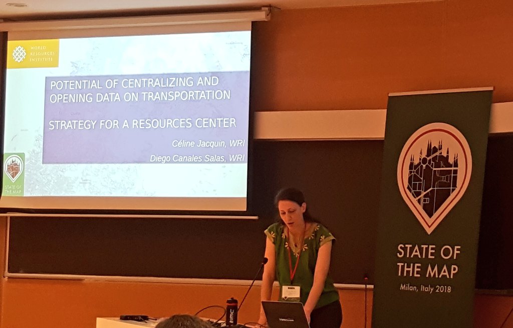
I have not participated in so many State of the Map conferences, only in two LATAM conferences, the first one being Sao Paulo in 2016, historical for me since the Geochicas were founded on this occasion and the following year in 2017 in Lima. I also participated in a Global conference in Milan (2018).

These conferences have seemed fundamental to me because of the links they generate, strengthen and activate. The OSM universe has a remote reality where in a somewhat miraculous way very strong human bonds of friendship, collaboration, emulation, creation, where it is possible to generate governance issues, where it is possible to build agendas and develop them. However, the face-to-face coexistence brings to this an additional unfailing strength: the friends we make at the State of the Map conferences remain forever. In addition, obviously, we discover themes, ways of impacting reality thanks to collaborative mapping, we update ourselves, we connect with people, companies, institutions and we all grow together.

That powerful sub-communities like Geochicas have emerged stimulated by one of these conferences is telling, Geochicas now being recognized globally for the actions and leadership it builds, and for what it manages to bring to the open technology communities of the geospatial world.

By connecting with people at these conferences, we also build bridges between national and regional communities allowing individuals to bring valuable knowledge in other contexts. I think of my connection with Jorge PB from Cuba, from SOTM Sao Paulo, which has led me to participate in other conferences in Cuba contributing there, I hope, some grain of sand.

See full entry

Location: Colonia 7 de Noviembre, Mexico City, Gustavo A. Madero, Mexico City, 07840, Mexico

No he participado en tantas conferencias de State of the Map, únicamente en dos conferencias LATAM, la primera siendo Sao Paulo en 2016, histórica para mí ya que se fundaron las Geochicas en esta ocasión y el año siguiente en 2017 en Lima. También participé en una conferencia Global en Milán (2018).

Estas conferencias me han parecido fundamentales por los vínculos que generan, fortalecen y activan. El universo de OSM tiene una realidad remota donde de manera algo milagrosa se logran vínculos humanos muy fuertes, de amistad, colaboración, emulación, creación, donde se logra generar temas de gobernanza, donde se logra construir agendas y desarrollarlas. Sin embargo la convivencia presencial aporta a eso una fuerza adicional indefectible: los amigos que nos hacemos en las conferencias de State of the Map quedan para siempre. Adicionalmente, obviamente, descubrimos temáticas, formas de impacto en la realidad gracias a la cartografía colaborativa, nos actualizamos, conectamos con personas, empresas, instituciones y crecemos todos en conjunto.

Que sub-comunidades poderosas como Geochicas hayan aparecido estimuladas por una de estas conferencias es revelador, Geochicas siendo reconocida globalmente ahora por las acciones y liderazgos que construye, y por lo que logra aportar en las comunidades de tecnologías abiertas del mundo geoespacial.

Al conectar con personas en estas conferencias, también creamos puentes entre comunidades nacionales y regionales permitiendo que individuos aporten conocimientos valioso en otros contextos. Pienso en mi conexión con Jorge PB de Cuba, desde SOTM Sao Paulo, que me ha llevado a participar en otras conferencias en Cuba aportando allí, espero, algún grano de arena.

See full entry

Location: Colonia 7 de Noviembre, Ciudad de México, Gustavo A. Madero, Ciudad de México, 07840, México

Durante la última semana de noviembre, participé a la Conferencia de Gestión popular de riesgos de desastres y OpenStreetMap LATAM 2022 organizada por OSM Perú y el nuevo capítulo de Youthmappers Llamitas Mapeadoras, en la Universidad Nacional Mayor de San Marcos en Lima.

Aquí redacto unas reflexiones personales como contribuidora de OSM LATAM.

1.Fue un evento muy concurrido, sin ser un State of the Map y siendo esencialmente un evento nacional, pero con participantes internacionales. Pero rescato sobre todo que tuvo una participación de personas realmente interesadas en el tema y con real intención de colaborar, conocer, escuchar de experiencias de otr@s, reflexionar junt@s para aportar a sus situaciones comunitarias en materia de gestión de riesgo, y esto desde un enfoque no especialista y profesional, sin tampoco cerrarse al mismo. En este sentido, para mi, fue un evento muy integrador y me emocionó mucho. Logró la “I” de la sigla “GIRD”.

See full entry

Location: Roma Sur, Ciudad de México, Cuauhtémoc, Ciudad de México, 06760, México

Recimentar la comunidad OSM LatAm

OSM LatAm como comunidad se consolidó, se puede decir, a raíz de un evento de AbreLatam ConDatos en la Cineteca Nacional de México en 2014, al darnos cuenta que varias personas usuarias y apasionadas de OSM, desde varios países, estábamos presentes, pues nos conocimos y decidimos crear un canal común para reunir a las personas de esta región.

De allí nació el canal de Telegram OSM-Latam, lista de email y Twitter. Telegram en particular se ha vuelto un espacio con participación variable pero intensiva desde entonces, sin necesariamente resultar en actividades conjuntas como región.

A raíz de discutir sobre esta oportunidad nuevamente al final de 2021, el grupo MapTime Bogotá contó cómo sus actividades locales, juntas mensuales y actividades como la resolución organizada de notas, habían logrado consolidar mucho la comunidad en Bogotá, y acordamos su ayuda para impulsar el arranque de algo similar a nivel LatAm. Porque a veces solo falta un empujoncito o una palmada.

Acordamos al menos tener una junta periódica, la primera siendo una parte misma de la junta mensual de MaptimeBogotá. Allí nos conocimos varias personas, tomamos unos acuerdos iniciales como principalmente qué hacer con esta junta, cómo comunicarla y moderarla de manera que facilite la integración de más personas, y construimos una agenda “cumulativa” que se irá tratando poco a poco permitiendo avanzar y también socializar. Estarán documentadas en la ahora página de wiki LatAm

Actividades detonadoras: el Notathón

MaptimeBogotá y Fundación OSM Colombia ya tenían instalada esta actividad, y por lo dicho sirvió bastante para federar las personas alrededor de OSM y hacer grupo, además de mejorar el mapa notablemente, y encontrar un medio de comunicación sana y de integración con mapeadores ocasionales que contribuyen más con notas que con mapeo directo.

See full entry

Location: Centro, Ciudad de México, Cuauhtémoc, Ciudad de México, 06000, México

Este mes de octubre de 2020, se ha lanzado oficialmente el capítulo de YouthMappers en la Universidad Autónoma del Estado de México (UAEM), facultad de Geografía, en el campus de Toluca.

Alt text

See full entry

Location: Delegacion De San Mateo Oxtotitlan, Toluca, Estado de México, 50100, México

Geochicas is a group of Spanish-speaking women from OpenStreetMap formed before SOTM-LATAM in Sao Paolo in 2016, around the pre-event discussions about the very low participation of female in proposals.

Derived from this observation in the Telegram channel of OSM-LATAM, the discussion about the low participation of women in this regional chat as well as in the community in general, in its local, regional and global scales was broadened.

Following this observation, @SeleneYang (Argentina), @Mapanauta and @Mapeadora (Mexico) decided to organize together a series of activities in this SOTM to initiate a collective reflection on gender inequality in this regional community, raise the key issues, develop perennials lines of work.

These lines were:

  1. The decision to have in every SOTM-LATAM a space for reflection on gender equity in the form of a talk and a panel with the assembly, looking for continuity
  2. Form a group of women with a reserved chat called Geochicas, created in the conference with about 30 attendees
  3. Have a proactive communication effort in the OpenStreetMap LATAM networks to keep the debate on gender equity active
  4. Promote in the group of women peer-to-peer teaching of technical and theoretical topics
  5. Promote our continuous participation in data and free technologies events, and a systematic participation in the SOTMs.

From 3 people the group grew during Sao Paolo- SOTM event to 30, and brings together, a year and a half later, around 150 people of diverse origins, from numerous communities, with very broad profiles.

See full entry

Location: Algarín, Ciudad de México, Cuauhtémoc, Ciudad de México, 06880, México

Geochicas es un grupo de mujeres de Openstreetmap de habla hispana, formado poco antes del SOTM-LATAM en Sao Paolo en 2016, alrededor de los debates previos al evento sobre la muy baja participación femenina en las propuestas.

Derivado de esta observación en el canal de comunicación de OSM-LATAM (chat de Telegram), se amplió la discusión sobre la baja participación de mujeres en este chat regional así como en la comunidad en general, en sus escalas locales, regionales y global.

Siguiendo esta constatación, @SeleneYang (Argentina), @Mapanauta y @Mapeadora (México) decidimos organizar juntas una serie de actividades en este SOTM para iniciar la reflexión colectiva sobre la inequidad de género en esta comunidad regional, plantear los temas claves, desarrollar líneas perenes de trabajo.

Estas líneas fueron:

  1. La decisión de tener en todos los SOTM de este continente un espacio de reflexión en forma de charla y panel con la asamblea, sobre la equidad de género, podiendo dar continuidad y medir progresos
  2. Formar un grupo de mujeres con un chat reservado llamado Geochicas, creado en el mismo momento de la asamblea con unas 30 asistentes
  3. Tener un esfuerzo de comunicación proactivo en las redes de Openstreetmap LATAM para mantener activo el debate sobre equidad de género
  4. Promover en el grupo de mujeres la enseñanza de temas técnicos, el debate de nivel teórico
  5. Promover nuestra participación continua en eventos de datos y tecnologías libres y una participación sistemática en los SOTM.

De 3 personas el grupo creció durante el evento a 30, y reúne, año y medio después, a 150 personas de orígenes diversos, de numerosas comunidades, con perfiles muy amplios.

See full entry

Location: Algarín, Ciudad de México, Cuauhtémoc, Ciudad de México, 06880, México

On behalf of the organization where I work, World Resources Institute Mexico for the Latin America area, and also for my efforts as part of OpenStreetMap Mexico, I participated in the State of the Map 2018 in Milan. I got a scholarship from the organizers, for which I am very grateful. I presented a state of the art on public transport data standards such as can be used in countries not very advanced technologically speaking and with low technical capacities in governments to integrate data to urban planning, with the challenge then of promoting useful and timely information. I finally presented the interest for several global organizations, to allow improvements in this topic, to group and concentrate resources, approaches and debates: data repositories, technologies, data collection methodologies and also form a visible, accessible, friendly platform and perennial to link actors and share experiences.

Alt text It can be viewed at minute 30:00 of the video of the event.

See full entry

Location: Algarín, Mexico City, Cuauhtémoc, Mexico City, 06880, Mexico

En nombre de la organización donde trabajo, World Resources Institute México para el área de América Latina, y también de mis esfuerzos como parte de Openstreetmap México, participé en el State of the Map 2018 de Milán. Obtuve un scholarship por parte de los organizadores, por lo cual estoy muy agradecida. Presenté un estado del arte sobre estándares de datos de transporte público tal cómo pueden ser utilizados en países no muy avanzados tecnologicamente hablando y con bajas capacidades en gobiernos para integrar datos a la planeación urbana, con el reto entonces de promover información útil y oportuna. Presenté finalmente el interés para varias organizaciones globales, para permitir mejoras en este tema, de agrupar y concentrar los recursos, enfoques y debates: repositorios de datos, tecnologías, metodologías de levantamientos de datos y también formar una plataforma visible, accesible, amigable y perene para vincular actores y compartir experiencias.

See full entry

Location: Algarín, Ciudad de México, Cuauhtémoc, Ciudad de México, 06880, México

OpenStreetMap Mexico’s data governance strategy

In Mexico, a working group of 8 people from the OpenStreetMap Mexico community has been formed since 2014, with varied profiles and several axes among which [1] the community training to add more users to OpenStreetMap, [2] the management with local and federal public institutions for the integration of OpenStreetMap and other geographical open data sources to their planning actions as well as for the opening of public data, and [3] an evolution of their methods to include a greater participation of the citizenship in the production and use of information.

One of the most consolidated topics of the international OpenStreetMap community is the generation and distribution of data in humanitarian contexts, in a preventive manner or after a crisis. The high frequency of natural cataclysms that affect the Mexican territory has given this group many opportunities for dialogue and collaborations with federal institutions and organizations (National Digital Strategy, CENAPRED, Red Cross, Doctors Without Borders, Greenpeace, Techo, Observatorio de la Vivienda, etc.), as well as towards affected states, for the generation and opening of up-to-date territorial data that make it possible to speed up rescue and reconstruction operations.

The first type of effort was training officials and organizations to familiarize them with OpenStreetMap and its potential for sustainable local management of territorial data. In response to various disasters since 2014, we have acted more directly to collaborate by providing information in real time to these institutions through tasking managers.

In parallel, we have had a constant effort of long-term linkage to establish a critical path where OpenStreetMap remains in the panorama of the actors of the data ecosystem for post-disaster interventions.

See full entry

Location: Obrera, Mexico City, Cuauhtémoc, Mexico City, 06800, Mexico

La estrategia de gobernanza de datos de OpenStreetMap México

En México, un grupo de trabajo de 8 personas de la comunidad OpenStreetMap México se ha conformado desde el 2014, con perfiles variados y siguiendo varios ejes entre cuales [1] la capacitación comunitaria para sumar más usuarios a OpenStreetMap, y [2] la gestión con instituciones públicas locales y federales para la integración de OpenStreetMap y otras fuentes de datos geográficos abiertos a sus acciones de planeación así como para la apertura de los datos públicos, además de [3] una evolución de sus métodos para incluir una mayor participación de la ciudadanía en la producción y uso de la información.

Uno de los temas más consolidados de la comunidad internacional de OpenStreetMap es la generación y distribución de datos en contexto humanitario, de manera preventiva o después de una crisis. La elevada frecuencia de cataclismos naturales que afecta el territorio mexicano ha dado a este grupo muchas ocasiones de diálogo y gestiones con instituciones federales y organizaciones (Estrategia Digital Nacional, CENAPRED, Cruz Roja, Médicos Sin Fronteras, Greenpeace, Techo, Observatorio de la vivienda, etc.), así como hacia estados afectados, para la generación y la apertura de datos territoriales actualizados que permiten agilizar las operaciones de rescate y reconstrucción.

El primer tipo de esfuerzos fue de capacitaciones a funcionarios y organizaciones para familiarizarlos con OpenStreetMap y su potencial para una gestión local sustentable de los datos territoriales. Ante distintos desastres desde el 2014, actuamos de manera más directa para colaborar aportando información en tiempo real a estas instituciones a través de tasking managers.

De manera paralela, hemos tenido un esfuerzo constante de vinculación a largo plazo para establecer una ruta crítica donde OpenStreetMap quede en el panorama de los actores del ecosistema de datos para intervenciones post-desastre.

See full entry

Location: Algarín, Ciudad de México, Cuauhtémoc, Ciudad de México, 06880, México

How does the OpenStreetMap community perceive gender equity?

Posted by mapeadora on 21 June 2018 in English. Last updated on 9 December 2020.

In #Geochicas -women from OpenStreetMap in Latin America-, we want to contribute to the debate on discriminations and gender inequality in the community with concrete data, and also with testimonies. For this purpose, we have built a survey disseminated in the community during most of the year 2017, in 7 languages.

The preliminary results have been analyzed and presented in the State of the Map Latam in Lima in 2017 and Global State of the Map in Aizuwakamatsu in 2017. The full results will be presented at the global State of the Map in Milan in July 2018

While we update the results, I share here the preliminary results, which illustrate the community’s experience of discrimination and harassment between genders. The survey has been disseminated on all OpenStreetMap channels and on social networks, repeatedly during 2017.

  • People from 14 countries answered the survey
  • 33 men and 24 women
  • About 60% of women have had difficulty expressing a point of view or have felt minimized by men in their community
  • About 73% of men consider that no one in their community has difficulty expressing themselves or defending their point of view
  • 33% of women have felt hostility from men in their community
  • 82% of men consider that there is no hostility towards women or another sub-represented gender within their community
  • 82% of men and 75% of women would consider it necessary to have codes of conduct and friendly spaces in the community
  • 20% of women and 28% of men consider that OpenStreetMap does not have a balanced gender representation
  • 22% of women, and 25% of men recognize that the lack of representation and participation of women negatively affects the data, the map, and community activities
  • 18% of women and 21% of men conclude that because of this inequality, the map and its uses do not benefit the entire population

See full entry

Location: Algarín, Mexico City, Cuauhtémoc, Mexico City, 06880, Mexico

En #Geochicas -mujeres de OpenStreetMap de América Latina-, hemos querido contribuir al debate sobre disciminaciones y desigualdad de género en la comunidad con datos crudos y concretos, y tambien con testimonios. Con este propósito hemos construido una encuesta diseminada en la comunidad durante casi todo el año 2017, en 7 idiomas.

Los resultados preliminares han sido analizados y presentados en el State of the Map Latam de Lima en 2017 y State of the Map global en Aizuwakamatsu en 2017. Los resultados completos serán presentados en el State of the Map global de Milan en Julio 2018

Mientras actualicemos los resultados, comparto aquí los resultados preliminares, que ilustran la experiencia de la comunidad sobre discriminación y acoso entre género. La encuesta ha sido difundida en todos los canales de Openstreetmap y en redes sociales, repetidamente durante 2017.

See full entry

Location: Algarín, Ciudad de México, Cuauhtémoc, Ciudad de México, 06880, México

The dialogue of the Openstreetmap LATAM community in the channels used (chats, lists, forums, events) has revealed a very low female participation and the need to develop a general and permanent reflection on gender in this community.

Staring 2016, with this objective, a group of 10 female mappers (Geochicas) has been formed within the community, who dedicate a particular effort to help the development of this debate, in addition to mapping activities directed by and toward women with a gender perspective. One of the channels for this debate is through the organization of panels for reflection and discussion at each event of the OpenStreetMap community (State of the Map) and different events in communities related to technologies and open data. Alt text

See full entry

Location: Algarín, Mexico City, Cuauhtémoc, Mexico City, 06880, Mexico

El diálogo de la comunidad Openstreetmap LATAM en sus canales (chats, listas, foros, eventos) ha revelado la muy baja participación femenina y la necesidad de desarrollar una reflexión general y permanente sobre género en esta comunidad.

A partir de 2016, con este objetivo, se ha conformado dentro de la comunidad un colectivo de unas 10 mujeres mapeadoras (Geochicas) que dedican un esfuerzo particular hacia el desarrollo de este debate, además de actividades de mapeo orientadas por y hacia mujeres con perspectiva de género. Uno de los medios para este debate, es a través de la organización de paneles de reflexión y discusión en cada evento de la comunidad Openstreetmap (State of the Map) y eventos de comunidades sobre tecnologías y datos abiertos.

Alt text

See full entry

Location: Algarín, Ciudad de México, Cuauhtémoc, Ciudad de México, 06880, México

The OpenStreetMap Latin American community communicates constantly in a Telegram chat in addition to other social networks, on technical issues, methodological challenges or local communities dynamics, projects, achievements, sometimes opinion debates, etc. The dialogue has led subgroups to form, as Geochicas last fall 2016, and collective projects to emerge around a conjuncture or a shared interest. A chat allows everybody to join a dynamic in process. Integrating, learning along the way or just observing, soaking up, and also identifying as a community. I think the anniversary mapathon was a great opportunity for this in the LATAM community.

A happy coincidence led this community to plan a continental scale mapathon, on the occasion of the 13th anniversary of OpenStreetMap.

From Mexico, after 2 years of repeated massive training efforts in universities and other civil and government communities, the tendency of the OSM Mex group is to make a pause and dedicate more, for a time, to the improvement of the map through remote mapathon promoted in the existing community.

On the other hand the group Geochicas, from their debates on the different ways to produce information and improve the database of OpenStreetMap in a sense that benefits women, and taking advantage of these activities to empower women in the community, we also decided a few months back to organize at some point a large remote mapathon on areas where women experience an acute level of vulnerability. Vulnerable areas, in general, would benefit from mapping and women, in particular, would receive an even greater impact as a result of overall improvement of information, as well as promoting a parallel and permanent mapping of equipment and points of interest considered useful for women. This second category of data, being more difficult to collect without a fine local knowledge, it seemed more feasible to organize a general mapathon of vulnerable settlements.

See full entry

Location: Algarín, Mexico City, Cuauhtémoc, Mexico City, 06880, Mexico

La comunidad latinoamericana de OpenStreetMap se comunica de manera constante en un chat de Telegram además de otros medios, sobre preguntas técnicas, retos metodológicos o de comunidades locales, proyectos, logros, a veces debates de opinión, etc. El diálogo ha llevado subgrupos a formarse, como fue el caso de Geochicas desde el otoño pasado 2016, o proyectos colectivos emerger entorno a alguna coyuntura, un interés compartido. Un chat permite unirse a una dinámica en proceso. Agregarse, aprender en el camino o simplemente observar, empaparse, y también interactuar e identificarse como comunidad. Considero que el mapaton aniversario fue una gran ocasión para esto en la comunidad LATAM.

Una feliz coincidencia llevó esta comunidad a planear un mapaton de escala continental, en ocasión del 13vo aniversario de OpenStreetMap.

Desde México, después de 2 años de esfuerzos repetidos de capacitación masivas en universidades y otras comunidades civiles y gubernamentales, la tendencia del grupo de OpenStreetMap es pausar este tipo de esfuerzo para dedicarse más, durante un tiempo, a la mejora del mapa a través esta vez de mapatones remotos promovidos en la comunidad existente.

See full entry

Location: Algarín, Ciudad de México, Cuauhtémoc, Ciudad de México, 06880, México

A sensitive mapping of public space, #CallesVioletas (VioletStreets)

Posted by mapeadora on 16 March 2017 in English. Last updated on 17 March 2017.

The exercises of mapping from the citizenship, which are the basis of the present introspection, take origin in the work group of #Repubikla. This group, through several projects articulated among themselves, encourages citizens and organized civil society to be empowered by generating robust data for public policies, and forms a framework where all the urban stakeholder are interrelated and aware from their different and complementary perspectives, in an inclusive way. These two objectives serve the central objective that is the construction of an egalitarian and inclusive city, with high participation in its processes, of the whole of the society.

Through the initiatives of #Mapeaton (Mapathon for and by pedestrians) and then #CrucesNegros (BlackCrosses), we have been approaching methods that sharpen our reading of public space, in a fine level of detail, and in its less visible and tangible dimensions, but more practical and perceptive.

Approaches to qualitative and inclusive methods of auditing the public space

Users of the streets that do not have any motor problem, are the majority of the people in charge of directing the walks during which the audits are carried out. What elements of the transit space can a person who walks without difficulty, easily notice? The tip of the iceberg, the most obvious tangible elements, that even a robot could interpret with banks of images of the city. And for this, we can soon leave the task to artificial intelligence systems (#Mapillary and #OpenStreetCam advance in this sense and will be a reality achievable in a few years).

See full entry

Location: Centro, Mexico City, Cuauhtémoc, Mexico City, 06000, Mexico

Evaluation of participatory transport mapping data: MapatónCDMX

Posted by mapeadora on 19 December 2016 in English. Last updated on 17 April 2021.

Why an evaluation?

OpenStreetMap is an international community of citizens, experts in open geographical data from different perspectives and specialties, and in collaborative methods to build information. OpenStreetMap is part of the Voluntary Geographic Information movement.

The Mexican OpenStreetMap chapter in preparation is involved in 3 main lines of action:

  • Strengthening the community (training and methodological support in projects, integration with academia and activism)
  • Procedures with government institutions for the importation of large public databases
  • Management with institutions to promote open and collaborative practices in its information management

As a global community and ecosystem of technologies, OpenStreetMap has participated in the past in several initiatives of informal transport mapping. This lack of good transport systems and lack of data is crucial in developing cities.

Objectives of transport mapping initiatives

These operations usually pretend to:

  • Create a complete transport system map to allow citizens to orient themselves in their city and make their mobility more efficient. Having this map allows more people to use collective transport instead of individual transport, with important implications on the mobility system, economy, environmental conditions, and the quality of life of people
  • Provide local governments with data to regulate their transport, when they do not exist in useful formats
  • Provide city and transportation planners with the necessary information to generate diagnostics, analysis, and design
  • Allow research and innovation on the subject of transport and mobility with georeferenced open data and with quality standards

See full entry

Location: Obrera, Mexico City, Cuauhtémoc, Mexico City, 06800, Mexico

Building a Women's work group in Openstreetmap Latin America, or How to Make Community

Posted by mapeadora on 11 December 2016 in English. Last updated on 19 December 2016.

The gender gap in technologies and information’s world is a commonplace, so assumed that few solutions are sought. This reflection appeared through an internal debate in the regional chat of OpenStreetMap Latam, allowing that the concerns of several people could concretize in a work line within the community. This text could also be a reflection on how to build community.

Why and how did the need to build a forum on the gender gap in OpenStreetMap appear

The OpenStreetMap community has various channels for relating, communicating information, giving directions, debating opinions: mailing lists, wikis and chats, country or region based, working group based. In the ConDatos 2014 event in Mexico City, where several people from the continent meet each other, linking the Openstreetmap community of Latin America in a more integrated way was proposed, firstly creating a mailing list and a regional chat. Alt text

See full entry

Location: Algarín, Mexico City, Cuauhtémoc, Mexico City, 06880, Mexico