
Minor Improvements to "OSM Latest Changes"
Air a phostadh le rene78 6 An Lùnastal 2025 sa chànan English“OSM Latest Changes” (https://rene78.github.io/latest-changes/) just got a few updates to make exploring recent edits more insightful - and smoother!
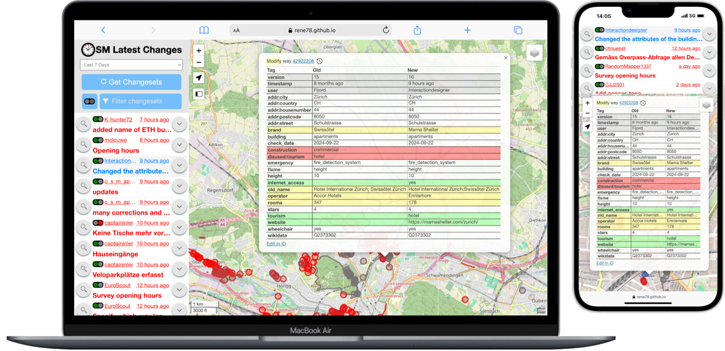
.png)

