“OSM Latest Changes” (https://rene78.github.io/latest-changes/) just got a few updates to make exploring recent edits more insightful - and smoother!

“OSM Latest Changes” (https://rene78.github.io/latest-changes/) just got a few updates to make exploring recent edits more insightful - and smoother!
“OSM Latest changes” (https://rene78.github.io/latest-changes/) got a few improvements:
.png)
Recently I have worked a bit on the web app “Latest Changes” (https://rene78.github.io/latest-changes/) in order to make it more mobile-friendly. Hope someone finds it useful.
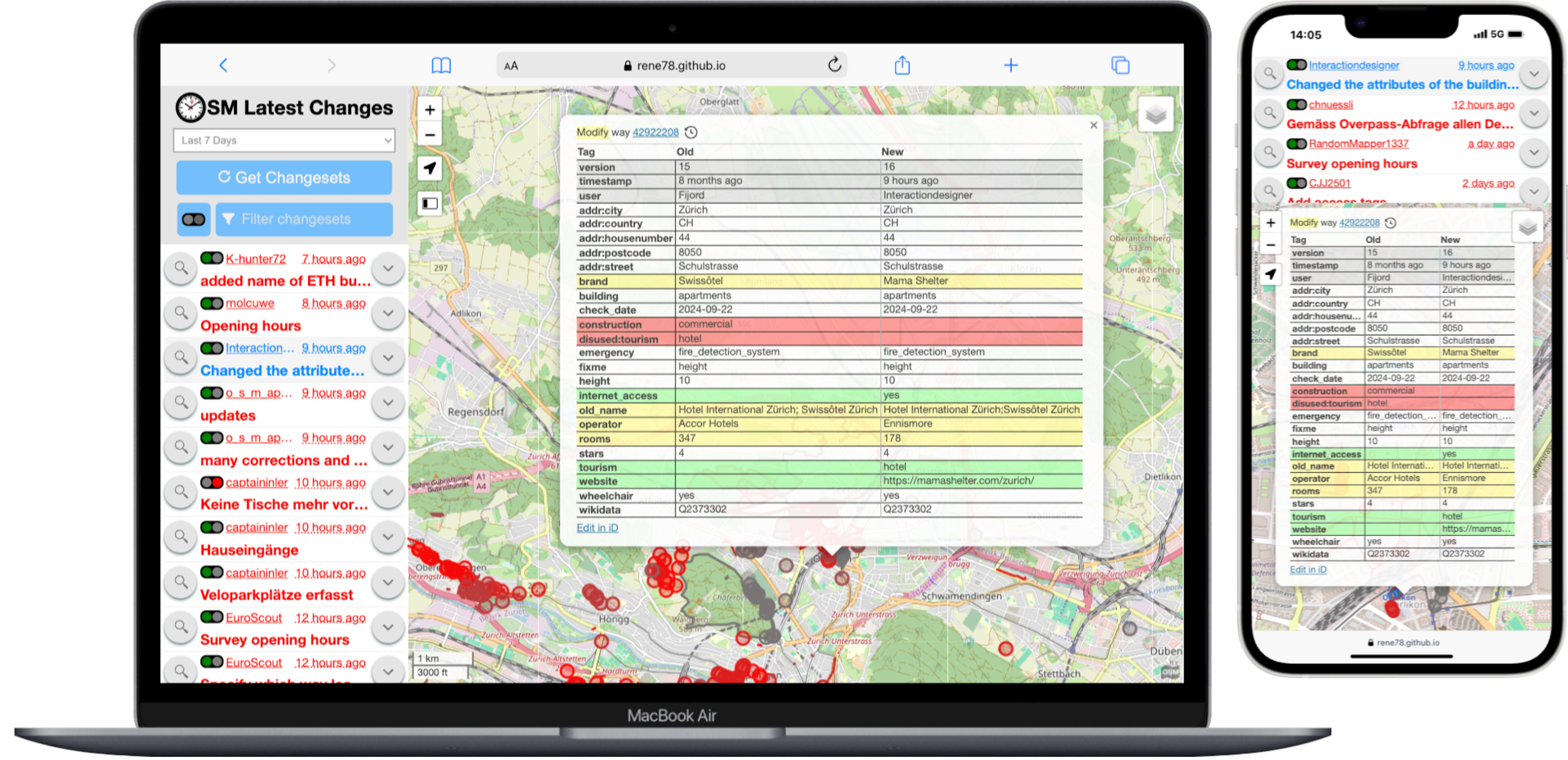
Quick reminder to the ones of you, who don’t know the app yet. The purpose is to check recent OSM changes within a certain cartographic boundary, for example your home town. It is very simple and powerful:
The link on top leads to my version of the app. The original one can be found under https://tyrasd.github.io/latest-changes/

I quickly want to introduce the tool “Latest Changes” to the ones of you, who don’t know it yet. The purpose is to check recent OSM changes within a certain cartographic boundary, for example your home town. It is very simple and powerful:
The link under 1. leads to my version of the app. The original one can be found under https://tyrasd.github.io/latest-changes/

I would like to recount an interesting encounter I had during a bike trip in Myanmar. In December 2016 I cycled from Yangon/Myanmar to Kuala Lumpur/Malaysia. Beforehand I was armchair mapping some tracks east of Bago, Myanmar in order to avoid the stinky and noisy main road and slightly short-cut the trip. Later I used OsmAnd+ to navigate those tracks.
It was precisely on these roads in the middle of nowhere - Google Maps is literally blank there - where I met a female solo bike traveller. She used Maps.me to navigate and was using ‘my’ roads to go into the opposite direction.
Quite entertaining to see the real world impact of all our mapping efforts.
Here is a picture of one of those newly mapped roads at a slightly different location.