OpenStreetBrowser: New category: Pedestrian footways
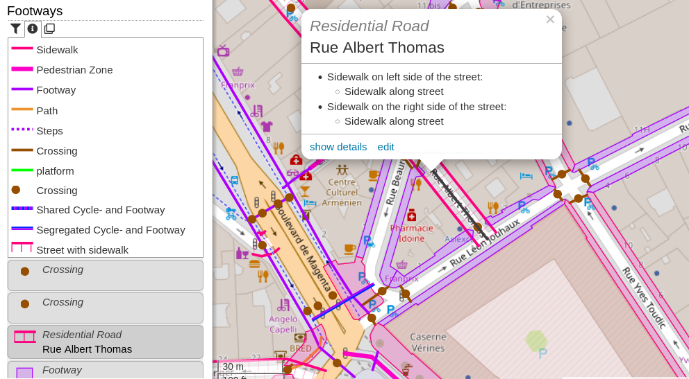
Verfasst von skunk am 10. Dezember 2022 in EnglishThe new “Footways” category (under Transportation -> Walking) shows sidewalks, footways, steps, platforms and pedestrian zones. Sidewalks mapped on the street way (sidewalk:left, sidewalk:right resp. sidewalk:both) will be shown with an offset - hatching indicates the relation.
If you have an questions, comments or ideas, please create an issue on Github! Quite some new strings were added to the translation system. Your participation is highly appreciated!
Diskussion
Kommentar von SLMapper am 23. Dezember 2022 um 18:48 Uhr
Looks great. Are you planning something similar for cycleways? I see you already mark shared footway/cycleway.
Kommentar von skunk am 25. Dezember 2022 um 21:52 Uhr
Maybe. I already tried it once, but cycleways are even more complex than footways with cycleway=opposite_lane, cycleway:left / :right, bicycle:oneway, …
I’m planning to add a ‘cycleway directions’ category, though, which shows the directions similar to the OpenCycleMap rendering.