"JustGo" : a new map for OSM (local) public transport data visualization
Opublikowany przez xoroc, 5.04.2020 w języku English. Ostatnio zaktualizowany 6.04.2020.So a few months ago I created an interactive site for public transports around Paris (here; also check my last post, in french) with a custom map made on Mapbox, and using Navitia’s API for itineraries, next departures, etc. But I thought this map design could be useful on its own, so I changed it so that you can download the data of any city you want very easily and it will be displayed on the map. I guess it can be useful because I don’t see a lot of OSM-based transport maps dealing with coloured bus & train lines. The site for this map is here (without itineraries because they are limited to a few places, but you can click on the data on the map and see the tags of the objects). It uses the Overpass API as well as osmtogeojson.
I also put the files on GitHub. (note : it’s the first time I use it, so I may have made mistakes idk).
Enjoy !
Note : if the layer “trains” doesn’t load, consider unchecking “include regional trains”
A few screeshots :
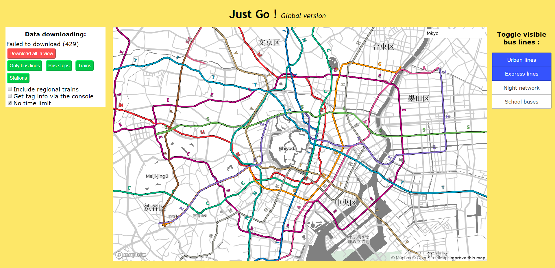
Tokyo subway network:
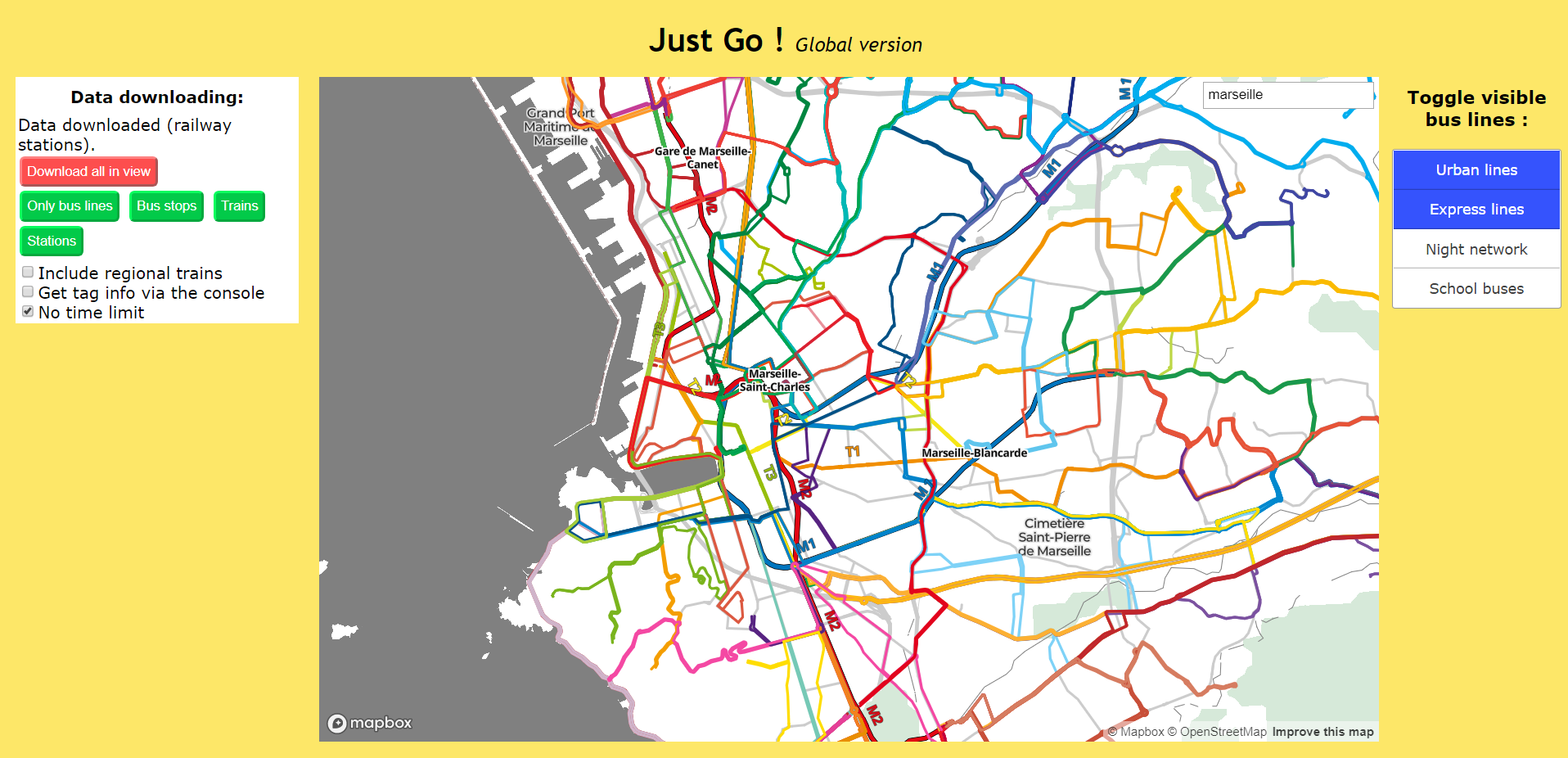
 Marseille, France:
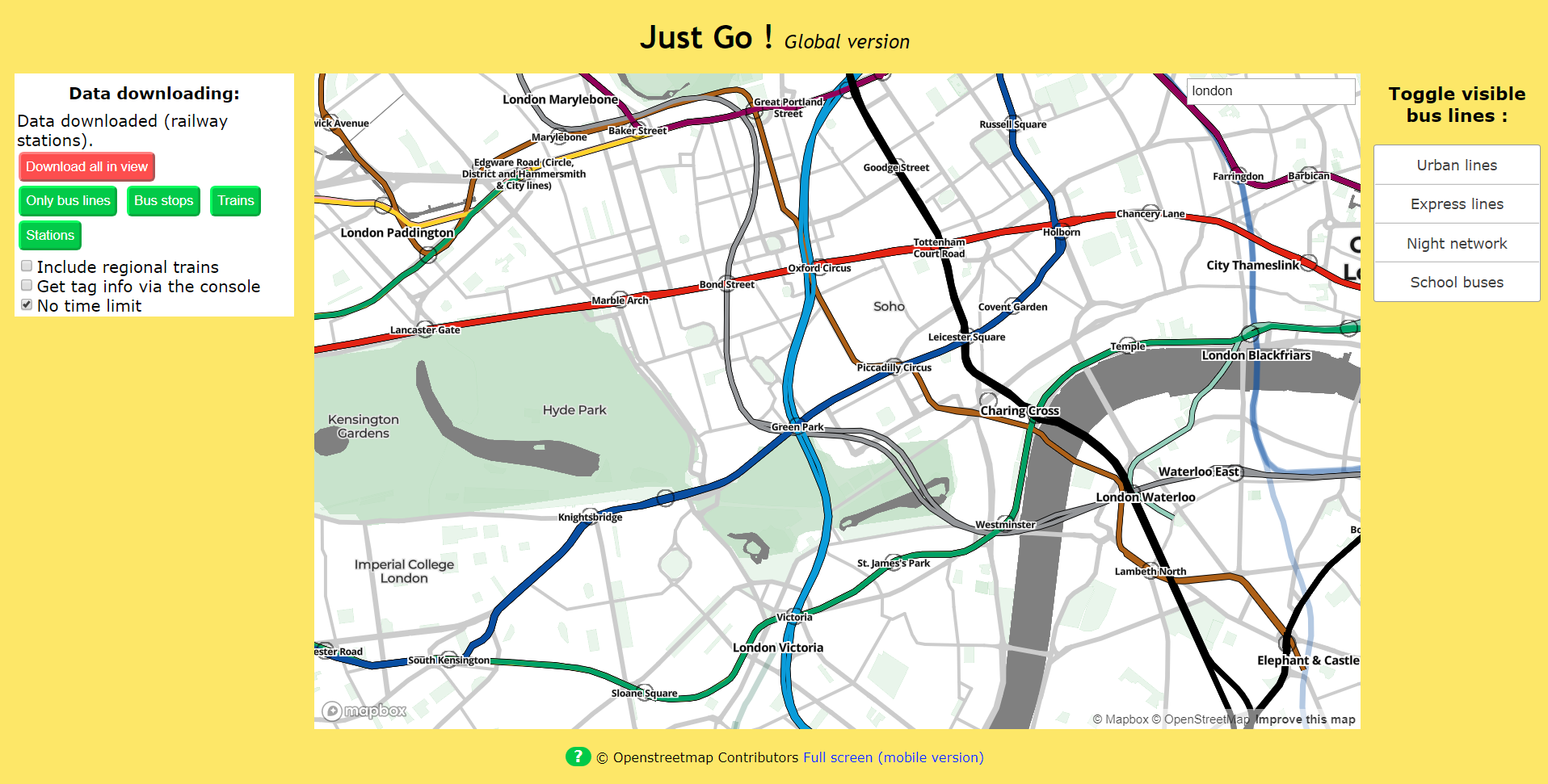
 Tube and stations, London:
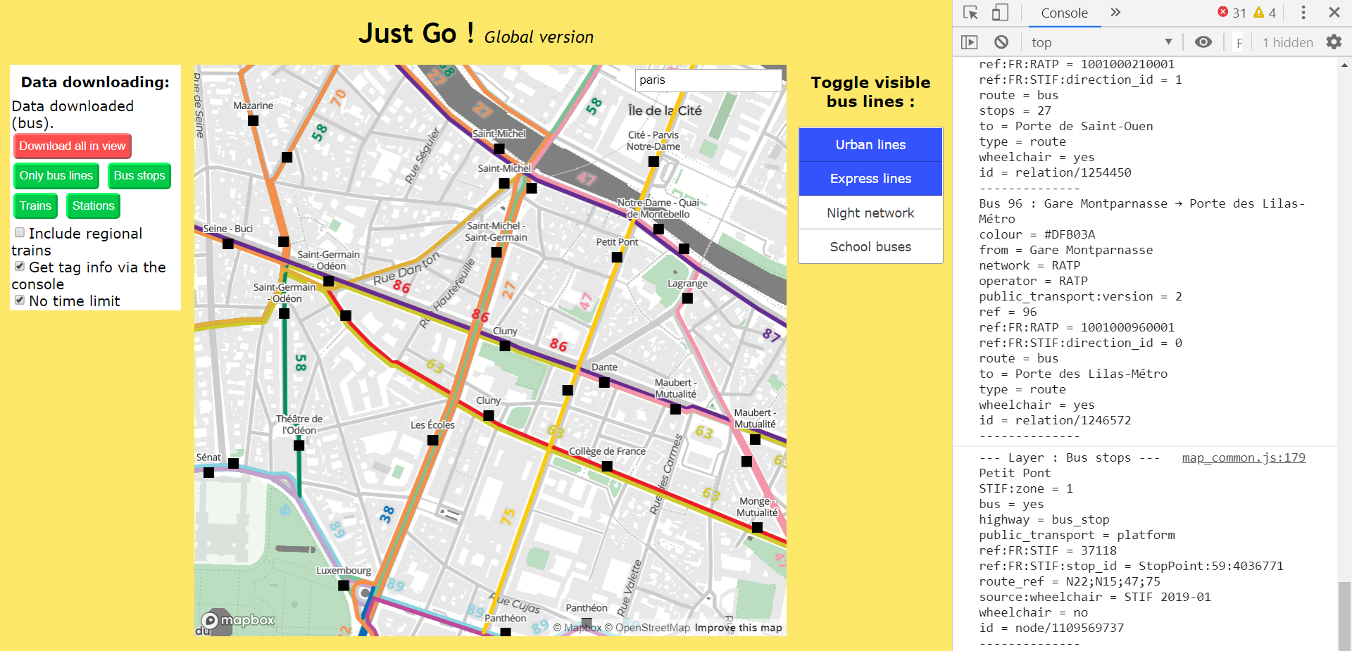
 Paris, buses and bus stops only, near Notre-Dame (with extra infor on the objects in the console) :
Dyskusja
Komentarz od gileri z 6 kwietnia 2020 o 08:43
Pretty neat !
Maybe you could mention that you are using Overpass API and the overpass-api.de server ? Their server is used by a lot of projects and having a mention is the least consumers can do :)
Komentarz od xoroc z 6 kwietnia 2020 o 09:03
Thank you ! I have mentionned it in this post and on GitHub now
Komentarz od PlaneMad z 8 kwietnia 2020 o 21:27
Very nice, tried it for India and shows the metro networks very well!
Komentarz od TheDutchMan13 z 24 kwietnia 2020 o 03:43
Thank you very much! :D