Users' Diaries
Recent diary entries

Background
I’ve mapped in OSM for many years now, but more of my work and been Bike-Pedestrian related, and I’ve only just come back around to mapping streets their widths and their number of lanes as a means to start evaluating crossings in our area. This means, despite my many years of mapping, I’m pretty terrible at getting the number of lanes forward/backward/both_ways and the corresponding turns associated with them correct. It’s just not that intuitive, although I can’t think of a better option.
My solution
A while back I discovered the JOSM ‘map paint styles’ specifically the lanes and enhances lane styles and combined with some tagging presets I’ve gotten acceptable at mapping major roads and the ability to visualize if I’m doing things right is a huge benefit.
The 12m (39’) of road that once visualized, haunts me.
Posted by Yabes09 on 15 August 2025 in Indonesian (Bahasa Indonesia).

Berdampak dari Jauh: Kontribusi OSM sebagai Dampak dari Manusia, untuk Manusia
Memori Bencana Intragenerasi: Kebimbangan dan Ketidakberdayaan diri untuk Berdampak
Masih jelas teringat di kepala saya banyak sekali bencana alam yang terjadi, yang saya tonton dengan jelas setidak-tidaknya sejak masa kecil di siaran televisi. Tsunami mentawai 2010, tsunami besar di Jepang 2011, fenomena megathrust Palu 2018, hingga banjir besar di Demak pada 2023 lalu yang saya baca dengan jelas di laman berita hingga sosial media pada saat itu. Sebagai negara kepulauan, sudah menjadi pengetahuan umum yang diserap bahwa Indonesia merupakan negara yang rentan mengalami banyak sekali bencana tektonis dan hidrometeorologis. Belakangan, banyak kalangan menyebut Indonesia sebagai negara "laboratorium kebencanaan" karena sering dan beragamnya bencana alam yang terjadi.

Tsunami Palu 2018. Sumber: Washington Post
Posted by AndreaDp271 on 15 August 2025 in Italian (Italiano).
5 anni fa ho iniziato a mappare su osm e devo dire che non ho mai avuto problemi con la mia community italiana, sopratutto perché le opinioni si esprimono in maniera dettagliata e cordiale, nonostante possano essere diverse.
Da quando ho scoperto che ci fossero linee guida consigliate nella wiki per gestire le bbox, ho cercato di ricordarlo a tutti gli utenti (alle prime armi o esperienziati) per semplificare le operazioni di noi locals nella verifica delle modifiche.
Purtroppo ho incontrato utenti non italiani che hanno espresso, attraverso ogni mezzo, il loro disappunto con prese in giro, umiliazioni e tutto ciò che ha a che fare con il bullismo.
Questa differenza tra la community italiana (dove si ragiona con serietà) e la parte rumorosa della communitiy internazionale (dove si risponde a suon di provocazioni) mi ha colpito a fondo rendendomi triste e ferito.
A questo punto mi sono chiesto se abbia veramente senso proseguire a migliorare la mappatura del territorio in cui vivo se sono circondato da utenti che non mi rispettano…
La risposta è sì, perché OpenStreetMap è un sistema open, bisognoso di dati e che ha bisogno di persone che cercano di fare il loro meglio, aiutando anche gli utenti “giovani” perché più siamo a mantenere un clima sano, più sano sarà il clima e coloro che rovinano il clima saranno sempre meno.
Dal punto di vista di gestire gli insulti e prese in giro che mi sono state recapitate mi sono già mosso come possibile, anche se l’operazione più efficace è stata quella di bloccare in tutti i social conosciuti, ove possibile, le persone che mi hanno schernito pubblicamente e privatamente.
Posted by AndreaDp271 on 15 August 2025 in English.
Five years ago, I started mapping on OpenStreetMap, and I have to say that I have never had problems with my Italian community, especially because opinions are expressed in a detailed and cordial manner, even when they differ.
Since I discovered that there were recommended guidelines in the wiki for managing bounding boxes, I have tried to remind all users—whether beginners or experienced—about them, to make it easier for us locals to verify edits.
Unfortunately, I have encountered non-Italian users who have expressed their disapproval through teasing, humiliation, and everything associated with bullying.
This contrast between the Italian community (where people reason seriously) and the noisy part of the international community (where responses come in the form of provocations) has struck me deeply, leaving me sad and hurt.
At this point, I asked myself whether it really makes sense to continue improving the mapping of the territory where I live if I am surrounded by users who do not respect me…
The answer is yes, because OpenStreetMap is an open system, in need of data and people who try to do their best, also helping “younger” users. The more of us maintain a healthy environment, the healthier the community becomes, and the fewer those who ruin it will be.
Regarding the insults and teasing I have received, I have already taken all possible actions. The most effective measure has been to block, wherever possible, on all known social platforms the people who publicly and privately mocked me.

As a passenger in a moving car, I like to do OSM field mapping, constantly scanning the view outside and noting every detail I can spot. The catch is, I need to do it fast. Too fast to worry about proper tagging or structured data entry. What I really want is an app that shows my current location on a basemap, lets me tap anywhere on it to drop a point, and attach a rough plaintext note. Later, once I’m back home, I could export all those coordinates and notes as a GeoJSON file, import it into iD Editor or JOSM, and take the time to think about proper tags.
A few weeks ago, while traveling to Bandung, I tried doing “quick, live mapping on the road” with Vespucci. It turned out to be a bit of a nightmare. Each time I spotted something, I had to stop the GPS autofollow, download OSM data, add a node, pick a tagging preset, fill out the details, upload, and then repeat the whole cycle. By the time I was done with one object, I’d already missed several others. That constant stop-and-go completely killed the flow of observation.
What I wanted instead was a much simpler loop: keep the GPS autofollow running, spot something interesting, click on the map, type a quick note, and move on. No tagging, no data downloads, no breaking the momentum. Just rapid-fire, location-anchored note-taking while the car keeps moving.
At first, I tried building a dedicated Android app to do this. Unfortunately, my Gradle setup was corrupted, and fixing it meant re-downloading everything, which would have taken far too long. That’s when I remembered a small web app I had built three years ago for a similar purpose, although back then it didn’t have GPS tracking. So instead of starting from scratch, I decided to just add the GPS feature to that old app.
The result is now live at http://altilunium.github.io/sakumaps/v2.
Eastern Road Travels
I’ve been continuing an anti clock-wise journey around Grenada.
Other Projects
Yeah there have been a month or two when work here stops. Often its just other projects but sometimes it’s a but like my day job.
Progress
I think this period started with Egmont, where I have family, through Calivigny, Fort Jeudy then all the Westerhalls. A lot of coastal details too at times. I did go inland but do not recall how far. Had fun doing the river along La Sagesse Beach Road and all the associated buildings. Loved doing Felix Park Rd. I met Dr G and spent an afternoon with him there. Very nice to meet a local botanist that I could learn from.
So now in August I’m nearing the end of Hope. From then on it’s all North and into 2026.

Seit heute befindet sich eine GoPro max (2025) in meinem Besitz. Dazu kommt dann ein ca. 150cm “Selfiestick” mit zwei Klemmen, der diese Kamera dann hoffentlich an meinem Fahrrad befestigen wird. Möglicherweise gönne ich mir noch vor dem Herbstequinox 2025 einen Magnetfuß für die KFZ-Montage. Ich werde berichten.
Mein Plan ist, damit zunächst Korbach und anschließend auch die Umgebung, für panoramax in 360°-Bildern zu dokumentieren. Dies in der Hoffnung, dass panoramax als Idee und Plattform stabil bleibt und uns allen eine zumindest nicht direkt vollständig von Großkonzernen abhängige Möglichkeit zur Speicherung und Nutzung von Straßenniveaubildern (natürlich nicht nur von Straßen im klassischen Sinn) bietet.
User Negreheb hat schon schöne, ausführliche diary-Einträge geschrieben, in denen erläutert wird, wie die Bilder aufgenommen werden und anschließend zur Plattform kommen. Ich danke für deine Arbeit und werde sie natürlich schamlos als Inspiration nutzen.
Zum Abschluss dieses Beitrags mein Angebot an Interessierte: Unter bestimmten Umständen lasse ich euch dieses Equipment gerne leihweise zukommen, damit auch bei Euch die Abdeckung mit 360°-Bildern zunimmt. Dafür dann bitte eine DM mit einer aussagekräftigen Nachricht, damit ich entscheiden kann, ob die “bestimmten Umstände” zutreffen (ich habe ehrlich gesagt noch keine festen Kriterien. Es wird erstmal eine Einzelfallentscheidung geben, die von diversen Faktoren abhängen wird. Tut mir leid, wenn ich da aktuell noch sehr ungenau bin).
happy mapping
Posted by wahyul_agraria on 15 August 2025 in Indonesian (Bahasa Indonesia).
Saya memulai sebagai mapper sejak tahun 2012 dan mengenal OSM di medio 2015. Memperoleh data spasial dalam tugas kuliah di tahun 2015 masih sulit dan terbatas. Saat itu untuk mendapatkan data vektor spasial, harus digitasi peta raster Rupa Bumi Indonesia atau digitasi dari google earth. Setelah mengulik di peramban web, saya menemukan bahwa tersedia data spasial indonesia secara free melalui geofabrik. Ini adalah anugrah Tuhan yang luar biasa. Setelah saya telusuri, ternyata sumber data ini dari komunitas openstreetmap. saya mempelajari bagaimana data itu tersedia secara free, dan ternyata berasal dari sumber terbuka. Dan saya tertarik bagaimana menjadi kontributor. Tahun 2018 saya mengikuti lomba pemetaan bencana yang diadakan oleh BNPB menggunakan JOSM/ device input data openstreetmap, yang datanya dapat dimanfaatkan untuk penanggulangan bencana. Ini hal yang luar biasa untuk pemanfaatan data spasial dari sumber terbuka.
salam
Wahyul Hidayat
2016年時曾有過討論與實踐,但因細故而無法繼續向前。以當時條件也不會獨自成立法人組織,而是依靠有法人組織身份的團體,行使相關簽約與帳目管理業務,另外還有收指定的專案捐款。
2025年在時機成熟後,並且在2025年8月14日發信遞件給基金分會與社群工作小組,事前已經取得台灣維基媒體協會的支持,將循義大利分會模式,以台灣維基媒體協會行使OpenStreetMap台灣身份加入成為分會。也有與網路上的 OpenStreetMap 台灣社群成員討論。
從2016年到2025年,OpenStreetMap在台灣,成為越來越多人使用的底圖,而且也有人看到上面傳統商業地圖欠缺的圖徵。社群成員在COSCUP等國內場合,以及國外的State of the Map、State of the Map Asia,Wikimania 的時候分享相關專案成果,例如村里。姐妹計畫的維基,維基年會於2023重回亞洲舉行,依據分區自治精神的ESEAP會議,串連,也交流不只維基媒體運動還有開放街圖。
未來期待比較有組織化,有計畫事項的方式,來進行相關的國內推廣,與國外合作事項。重新舉行 State of the Map Taiwan,以及籌辦 State of the Map Asia 都是可以討論的事項。
Posted by Nicolás Antonio Celano on 14 August 2025 in Spanish (Español).
.jpeg)
La vida es maravillosa
Good afternoon from sunny, hot, and muggy northeast Florida!
I am still learning OSM, who is not, and having a blast doing it. It is increadibly fun and incredibly fascinating. Always see and find something new every single day! Love it!
Right now I decided to make the jump to JOSM. I know it is a little or a lot complicated. Best way to learn is jump and start going. When I downloaded it the current version, 19423, was not active I down loaded a earlier version and needed to update. I was literally looking at help files, Googling it, asking questions, a lot. But, and don’t ask me how, I eventually landed the current version, 19423, on my computer. It was one of those moments that you have no clue how you did something but who cares its finally done.
To get started I did the LearnOSM again. I sometimes have to do it over and over to get the idea. Its a good refresher as well. For someone like me who has multiple challenges the fact OSM allows for going back and being able to go over is really good. I saw some updates that and changes that need to be done based on the new JOSM version. I need to figure out who to send those to. Now I am on working on the LearnOSM JOSM - Detailed Editing. Thank you also for OSM having the ability to work on a mock community. That is tremendous and helps so so much.
I do wish that some of the tutorials were more accessible for people with challenges. I think that will allow for a entirely new population of folks to get mapping. We that are disabled and something like OSM for a lot of us is a pair made for each other. Its quiet and you can do it any place and in any environment. It really is a awesome combination. I have a lot of suggestions to make this happen. Need to find out whom to talk to about this as well.
Here are a few….
I noticed that on OpenStreetMap we were missing types of surfaces for many important roads in Kosovo.
Car navigators use surfaces when routing and calculating travel times.
So entering this information became a goal, a time bound mission I could do on my own within a short period of time and see the results, which is just what I like.
The roads in OpenStreetMap are largely classified as primary (highways), secondary (regional roads), tertiary (local roads) and residential.
I decided to work on the first three and smaller sections connecting these classified as primary_link, secondary_link and tertiary_link. The first three for the most part are asphalt in Kosovo, and it’s easy to guess when this may not be the case. Being larger, it’s also easier to confirm on aerial photography that they are indeed paved in asphalt.
First, getting a view of the situation. Here, Overpass turbo is great.
This code will highlight all the primary road surfaces that haven’t been specified.
[out:json][timeout:25];
way["highway"~"primary"]["surface"!~"."]({{bbox}});
out geom;
Change primary with secondary, tertiary, primary_link and so forth.
Next, map editing.
Going through roads one by one and looking at status is tedious. Here comes JOSM and the amazing filtering function I hadn’t used before.
Open Windows > Filter and enter:
highway=primary
Check E (enable) and I (inverse).
For the downloaded area of the map, this will highlight surfaces that need to be specified. Referring to all the aerial imagery available, change them to surface=asphalt and upload.
And voila, almost all primary, secondary and tertiary road surfaces in Kosovo have been completed. In some rear cases I couldn’t tell from aerial imagery available what the status was. I also didn’t work on residential roads which are much more in number but less critical for navigation and where local knowledge would be quite helpful.
Happy mapping!
Hey gang!
I went on a roughly 2-week hiatus because I was visiting my uncle down south. However, I am back and hopefully able to work on OSM more
The first thing I did when I came back was deal with some very old vandalism that was somehow undetected? So I managed to clear all that up and am now remapping it correctly
Anyways, thats enough from me! Goodbye!
NK-Mapper
As in my profile, yes I’ve been addicted to https://blacket.org for a while. If anyone joins it and wants to reach out, my username is 76 ingame and my discord username is .i76. (76). Just editing the overnight camp I attend right now. Being bored.
Another year has passed since my last entry, and it’s about two years ago that I resided in Bonaire for half a year. I want to visit again, but there’s that man on the side of my shoulder whispering things about a sustainable world :) (Meaning I can’t simply visit for a couple of weeks, but should stay for a longer period of time.)
Last year (2024), the Dutch government made high resolution aerial photos of Bonaire. I’ve already updated and mapped several areas based on this. As this information is both high resolution and recent it is very useful for mapping. You can find more information about this on https://www.beeldmateriaal.nl/dataroom-caribisch-nederland
In 2023 I stayed at the Hausmann Follies apartment complex. To compare the image quality, look at these photos:
Bing resolution:

Posted by AndreaDp271 on 13 August 2025 in Italian (Italiano).
Oggi 13/08/2025 ho creato il primo post sotto il mio profilo proponendo nuovi tags per gestire le aree della protezione civile, ben diverse dai punti di raccolta
EN
Hi there, and thanks a lot for your contribution! 🌟 Just a little tip for future edits: keeping changesets small and local can make things smoother for everyone. It helps prevent conflicts, makes it easier for fellow mappers to review, and keeps the map even more accurate.
A few friendly suggestions: • Focus edits within a small geographical area (like a single city, district, or province) • Try not to mix far-apart locations in one changeset • Save/upload before starting work in a totally different area
If you’re curious, the wiki explains more here: osm.wiki/Changeset#Geographical_size_of_changesets
Thanks again for your mapping energy, and happy mapping! 🗺️
Why is it important to remind both new and experienced users to keep changesets limited to a specific area? First of all, not all editors can handle loading large amounts of data, as happens with iD (link). More importantly, a large bounding box (covering, for example, half the world or all of Northern Italy) makes it harder for other mappers—both local and remote—to review the changes, even when using modern tools like Better OSM or OsmCha.
IT
Ciao, e grazie mille per il tuo contributo! 🌟 Un piccolo suggerimento per i prossimi cambiamenti: mantenere i changeset piccoli e localizzati può rendere il lavoro più semplice per tutti. Aiuta a evitare conflitti, facilita la revisione da parte degli altri mappatori e mantiene la mappa ancora più accurata.
Alcuni suggerimenti amichevoli: • Concentrati su un’area geografica ristretta (come una singola città, un quartiere o una provincia) • Evita di mescolare località lontane nello stesso changeset • Salva/carica prima di iniziare a lavorare in un’area completamente diversa
Se sei curioso, la wiki spiega di più qui: osm.wiki/Changeset#Geographical_size_of_changesets
Grazie ancora per la tua energia nel mappare e… buona mappatura! 🗺️
吉林省普通公路2023版
两环
G102、G229、G302、G334长春过境段新线=长春半小时环线
S001长春经济圈环线
两射
S101长吉线(长吉北线)
S102长双线
八横
G331丹东-阿勒泰
G503五常-通榆
S3??山河-太平川
G302珲春-阿尔山
G334龙井-东乌珠穆沁旗
G503抚松-公主岭+G608扎赉特旗-公主岭=抚松-扎赉特旗
G303集安-阿巴嘎旗
G333三合-莫力达瓦旗=莫力达瓦旗-三合
十二纵
S2??穆棱-珲春
S2??绥芬河-二道白河
G201鹤岗-大连
G222嘉荫-临江
G202黑河-大连
G229饶河-盖州
G102北京-抚远
G203绥化-沈阳
G232牙克石-四平
S2??王府-新宾
S2??齐齐哈尔-通榆
S2??嫩江-双辽
三十七联
S5??复兴-分水岭
S5??汪清-东宁
G610珲春-沙坨子
S5??三道湾-龙井
G611和龙-南坪
S5??敦化-和龙
S5??松江-露水河
S5??和平营子-天池北
S5??天池南-长白
G606五常-敦化
S5??天池西-松江河
S5??蛟河-凤凰山
S5??松花湖旅游环线
G612漫江-临江
S5??舒兰-陶赖召
S5??舒兰-大口钦
S5??桦甸-朝阳山
S5??辉南-三道沟
S5??白山-西丰
S5??石人-通化
S5??通化-桓仁
S5??烟筒山-辽源
G230通化-武汉
S5??营城子-小四平
G607哈尔滨-松原
S5??查干湖旅游环线
S5??秦家屯-八面城
S5??四平-杨木林子
S5??镇赉-莫莫格
S5??前七号-太平川
S5??到保-突泉
S5??通榆-向海
S5??洮南-科尔沁右翼前旗
S5??洮南-向海
G609珲春-珲春口岸
G506集安-本溪
- 吉林省标准地图
- 吉林省干线公路网规划(2022-2035年)
- 2014年-2030年吉林省省级公路网规划
- 吉林省普通国省道网布局方案示意图
- 吉林省高速公路网布局方案示意图(2014-2030)
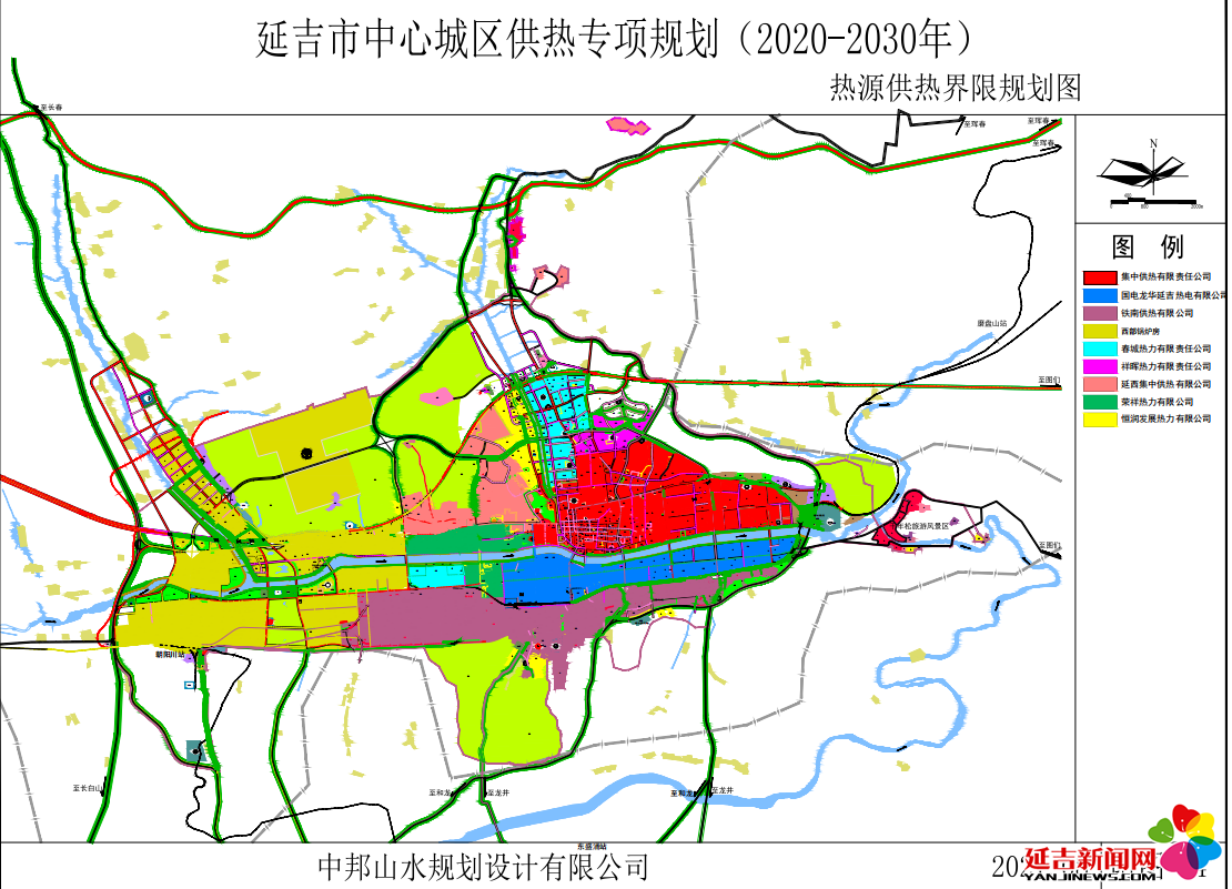
- 延吉市中心城区供热专项规划
- 延吉市学区调整图
- 延吉市国土空间生态修复规划
- 小营镇国土空间规划(2021–2035年)
- 依兰镇国土空间总体规划(2021–2035年)(无图)
- 三道湾镇国土空间总体规划(2021–2035年)(无图)
- 敦化市大石头镇国土空间总体规划(2021-2035年)
- 敦化市黄泥河镇国土空间总体规划(2021-2035年)
- 敦化市官地镇国土空间总体规划(2021-2035年)
- 敦化市沙河沿镇国土空间总体规划(2021-2035年)
- 敦化市秋梨沟镇国土空间总体规划(2021-2035年)
- 敦化市额穆镇国土空间总体规划(2021-2035年)
- 敦化市贤儒镇国土空间总体规划(2021-2035年)
- 敦化市大蒲柴河镇国土空间总体规划(2021-2035年)
- 敦化市雁鸣湖镇国土空间总体规划(2021-2035年)
- 敦化市江南镇国土空间总体规划(2021-2035年)
- 敦化市黑石乡国土空间总体规划(2021-2035年)
- 珲春市国土空间总体规划(2021-2035年)
- 珲春市春化镇国土空间总体规划(2021-2035年)
- 珲春市敬信镇国土空间总体规划(2021-2035年)
- 珲春市板石镇国土空间总体规划(2021-2035年)
- 珲春市英安镇国土空间总体规划(2021-2035年)
- 珲春市马川子乡国土空间总体规划(2021-2035年)
- 珲春市杨泡满族乡国土空间总体规划(2021-2035年)
- 珲春市三家子满族乡国土空间总体规划(2021-2035年)
- 珲春市密江乡国土空间总体规划(2021-2035年)
- 珲春市哈达门乡国土空间总体规划(2021-2035年)
- 龙井市国土空间总体规划(2021-2035年)
- 龙井市矿产资源总体规划(2021–2025年)
- 龙井市生态修复规划(2021–2035年)
- 龙井市智新镇国土空间总体规划(2021–2035年)文本
- 龙井市智新镇国土空间总体规划(2021–2035年)图纸
- 龙井市白金乡国土空间总体规划(2021–2035年)
- 龙井市德新乡国土空间总体规划(2021–2035年)
- 安图县国土空间总体规划(2021–2035年)
- 安图县明月镇国土空间总体规划(2021–2035年)
- 安图县松江镇国土空间总体规划(2021–2035年)
- 安图县二道白河镇国土空间总体规划(2021–2035年)
- 安图县两江镇国土空间总体规划(2021–2035年)
- 安图县石门镇国土空间总体规划(2021–2035年)
- 安图县万宝镇国土空间总体规划(2021–2035年)
- 安图县亮兵镇国土空间总体规划(2021–2035年)
- 安图县新合乡国土空间总体规划(2021–2035年)
- 安图县永庆乡国土空间总体规划(2021–2035年)