OpenStreetMap logo OpenStreetMap

Users' Diaries

Recent diary entries

Mały wąwóz

( kilka - kilkadziesiąt metrów, bez wody / PL: 1-2.5 m szer. i mniej)) osm.wiki/Pl:Tag:natural%3Dgully

Żleb

Dolina

Skarpa

  • uskok skalny natural=earth_bank + earth_bank=scarp

Strome, trawiaste zbocze natural=earth_bank + earth_bank=grassy_steep_slope
Posted by SomeoneElse on 23 August 2025 in English. Last updated on 31 August 2025.

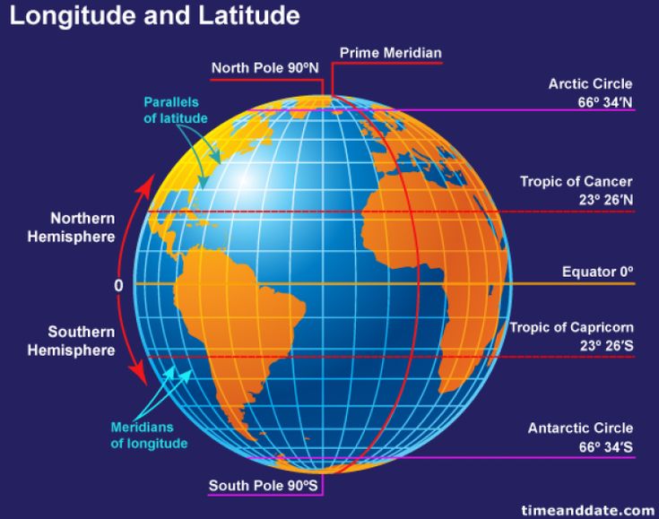
A globe view centred on the Indian Ocean

tl;dr: slightly less than an hour.

This was prompted initially by a forum comment (I can’t actually remember exactly where or by whom) that creating maps based on OSM was for “developers” and not “normal people” (not in those exact words), and by the thread here. The “slightly less than an hour” actually includes setting up a development environment from scratch on a new PC.

On that new PC I’ve already installed a text editor and a web server (“apache2”).

cd ~/src
git clone https://github.com/SomeoneElseOSM/SomeoneElse-vector-web-display
git clone https://github.com/systemed/tilemaker

In the first of those repositories there are a selection of map styles, including one that uses the OSMF demo vector tiles. Let’s first test that that works:

See full entry

Location: 2.470, 17.690

(english translation by OpenAI/chatgpt)

RETEX: Tagging Choices for My Urban Recycling Trekking

Hesitations, discussions, collisions with other contributors, changes, hesitations… but convergence.

to be continued maybe:

  • journal entry (upcoming): Existential questions about my encounter with Panoramax

At first, tagging the operator since it’s the target of the trekking.

The operator is known here as GPSEO, or GPS\&O, or Grand Paris Seine and/& Oise… Which name to choose? Likewise, I encountered clothing containers from Le Relais or Emmaüs, and again, which names should be used?

my encounter with Wikidata

Thanks to the forum, I was guided towards Wikidata, which allows assigning a unique code to a large number of resources (companies, operators, municipalities, associations, widely known people, …).

Once the resource in question is given a Wikidata code, its Wikidata entry contains important data (name, website, Wikipedia reference, revenue, …) and thus allows all Wikipedia collaborative applications to access these elements in a common way. So it is enough to reference the operator’s Wikidata code in OSM tags to identify it uniquely and stably. From this code, it’s easy to retrieve the operator’s website, its Wikipedia reference, and other useful information without having to explicitly add them as OSM tags (which would require updating OSM every time the data changes).

A single concession seems necessary: I retrieved the operator’s official name from its Wikidata entry and added it as an OSM tag for readability.

And therefore:

operator=GRAND PARIS SEINE ET OISE operator:wikidata=Q19945071

Tags deliberately omitted because the information is evolving and can be found in the operator’s Wikidata article:

operator:wikipedia, operator:website, operator:short

And similarly:

operator=Emmaüs operator:wikidata=Q989437

operator=Le Relais operator:wikidata=Q16654240

ref or operator:ref

See full entry

RETEX : Les choix de tag pour mon trekking urbain recyclage

Hésitations, discussions, collisions avec d’autres contributeurs, changements, hésitations, … mais convergence.

à suivre peut-être :

  • entrée de journal (à venir) : Questions existentielles sur ma rencontre avec panoramax

Au départ, taguer l’opérateur puisque c’est la cible du trekking.

L’opérateur est connu ici sous le nom GPSEO, ou GPS&O, ou Grand Paris Seine et/& Oise …. . Quel nom retenir ?
De même, j’ai rencontré des conteneurs à vêtements du Relais ou de Emmaüs et, là encore, quels noms retenir ?

ma rencontre avec wikidata

Grâce au forum, j’ai sur ce sujet été orienté vers wikidata qui permet d’affecter un code unique à un grand nombre de ressources (sociétés, opérateurs, communes, groupements, personnage à portée large, …).

Une fois la ressource concernée dotée d’un code wikidata, son entrée wikidata contient les données importantes (nom, site web, référence wikipedia, chiffre d’affaires, … ) et permet ainsi à toutes les applications de la sphère collaborative wikipedia d’accéder de façon commune à ces éléments. Il suffit donc de référencer le code wikidata de l’opérateur dans les étiquettes OSM pour identifier celui-ci de façon unique et stable. A partir de ce code, il sera aisé de retrouver le site WEB de l’opérateur, sa référence wikipedia et autres renseignements utiles sans avoir à les mettre comme étiquettes explicites de OSM (ce qui obligerait à mettre à jour OSM chaque fois que ces données changent).

Une seule concession nécessaire, me semble-t-il : j’ai récupéré le nom officiel de l’opérateur dans ses données wikidata et l’ai mis en étiquette OSM pour plus de lisibilité.

Et donc :

operator=GRAND PARIS SEINE ET OISE
operator:wikidata=Q19945071

étiquettes omises volontairement car les informations sont évolutives et peuvent être trouvées dans l’article wikidata de l’opérateur :

operator:wikipedia, operator:website, operator:short

Et, de même :

See full entry

Posted by WilburSunflower on 21 August 2025 in English.

Greetings whoever is reading this, including my future self who may be the only audience.

I was invited earlier this year to take part in an exhibit called [“Compass Roses”] (https://www.compassroses.art/), which will be on view at Opalka Gallery in Albany, NY this Fall.

“Compass Roses: Maps by Artists is a national artwork co-curated by Nadine Wasserman and Renee Piechocki. The project offers a selection of maps created by visual, literary, and performing artists. “

I chose to make a map of Gun Violence Memorials in Albany. I was inspired by a memorial called Chyna’s World, a mural in memory of an 18-year old high school senior named Chyna Forney. Chyna was killed in crossfire in an incident when her boyfriend fired over 30 rounds at another man. The mural is painted at the location where the incident took place. After seeing this mural, I wondered if there were others like it.

I have been aware of the problem of gun violence for this entire century. I have perceived it from three aspects that touch but are distinct: school shootings, the eclipse of streetfighting, and police murder. I might say more about those three in this diary over the next few months, but for now I will just say that these have been buried the past five years by the sheer numbers of tragic gun deaths in this country, in my city, in my neighborhood, on my street. There were 10 shootings on my street when the world broke down during New York Pause, from April 27 2020 a few weeks into the pandemic through December 19, 2021. The nadir was the late night murder of 15-year old Destiny Greene, on a magical little street called Wilbur. I remembered the temporary monument that Destiny’s family had set up on Wilbur Street, and the attempts by some neighbors to set up a permanent memorial for shooting victims.

See full entry

Location: Mansion District, City of Albany, Albany County, New York, 12223, United States
Posted by pnorman on 20 August 2025 in English.

Vector Tile styles require icons are served in a sprite sheet. This contains all of the icons in one file. Years ago there were a few options for these, none of them great. These days, there are three common options: spreet, @basemaps/sprites, and sprite-one. The first is written in Rust while the other two are written in Javascript.

All have the same basic functionality of turning a folder of SVGs into a json+png spritesheet, and doing so at multiple resolutions. Spreet has the additional option of de-duplicating icons. If two icons are identical it will only put one copy in the PNG and reference the same image twice.

I benchmarked all three options with two sets of sprites: all the SVGs from OpenStreetMap Carto, and the OpenStreetMap Americana icons. The former is 973 icons and the latter is 248 icons. These are larger than a typical set of icons but are a good test.

  Test spreet sprite-one @basemaps/sprites
osm-carto SVGs @1x pixels 4194304 4078074 8339456
osm-carto SVGs @1x bytes 513159 763531 837792
osm-carto SVGs @1x bytes after oxipng 474750 649894 706845
osm-carto SVGs @2x bytes 1442588 2176457 2411489
osm-carto SVGs @2x bytes after oxipng 1325707 1896784 2088729
osm-americana @1x pixels 128265 122400 151760
osm-americana @1x bytes 75749 91870 92066
osm-americana @1x bytes after oxipng 75497 84986 85828
osm-americana @2x bytes 136177 213876 210650
osm-americana @2x bytes after oxipng 132462 197687 194950

See full entry

Tiens , puisque je ne savais pas ou garder les liens vers certaines de mes photos 360° , je vais les mettre ici:

Et puis il y a les sites d’escalade, certains sites sont jolis , et d’autres moins, et n’ont peut être que d’intérêts pour les grimpeurs. :

I’m importing boundaries in Croatia, and I’m almost done. So I wanted to describe my process so that someone else maybe doesn’t have to rediscover this process. Maybe there is a better one, but I didn’t find it.

Croatia in OpenStreetMap had admin_level=7 borders imported, but the borders were not precise. So my job was to import admin_level=8 into these. I had the data in .osm format, and a license that is compatible. I wanted to keep the history of the old boundaries, so deleting everything and just copying inside wasn’t a choice.

First we need JOSM, and some experience with it. We turn on the Expert Mode in View. We need to install the plugin “utilsplugin2”. Then we go to Map Paint Styles in Preferences, and turn on the “Admin Boundaries” style.

So the process goes like this. In JOSM I open the .osm file with all the admin_level=8 boundaries. Then I download the area where I intend to work, but I use “Download from Overpass API” feature. In it I add the next Overpass query:

[out:xml][timeout:90][bbox:{{bbox}}];
(
relation["boundary"="administrative"];
)-> .adminrelations;
(  .adminrelations;
  way(r);
) -> .ways;
(
  node(w.ways);
)-> .nodes;

way(bn.nodes);
(._;<;); (._;>;);
out meta;

What this query does is it downloads all the boundary relations, and all the ways that are connected to them.

1. Disconnecting

Next step I did was to disconnect all the roads, forests, rivers and anything that is not a boundary from the existing boundaries. I upload that, and later download a cleaner situation.

2. Splitting

See full entry

When using OSM’s iD editor in New South Wales, Australia, there are multiple background layers you can enable that show aerial/satellite imagery. Different imagery sources can vary greatly in terms of how recent and/or blurry they are. Here I’ll discuss my experience using them.

OpenStreetMap's background layers for NSW, Australia

DCS NSW Imagery

This is my preferred imagery source, primarily because it’s very clear even at high zoom levels. You can see lots of detail which makes it great for mapping.

Unfortunately it’s also the oldest of the imagery sources for NSW. In Armidale it’s dated 2018, but other towns can be as old as 2009! You can enable the “DCS NSW Imagery Dates” overlay to see what date the imagery for a given area was taken.

Esri World Imagery

See full entry

Depois de mais de uma década contribuindo para o OpenStreetMap (OSM), finalmente decidi criar este blog. Quero compartilhar minhas experiências e mostrar o porquê de eu me dedicar tanto à melhoria do mapa. Acredito que esta seja uma maneira interessante de as pessoas entenderem o valor do mapeamento voluntário e a importância de ter um mapa preciso e detalhado, feito por pessoas para pessoas.

Minha jornada de mapeamento pelo Brasil Minha jornada começou melhorando o mapeamento do Espírito Santo, meu estado de residência, que conheço muito bem. Com o tempo, meu trabalho se expandiu para outras regiões que tive a oportunidade de conhecer, seja por viagens a trabalho, cicloviagens ou em passeios com a família.

Hoje, minhas contribuições se espalham por várias regiões do país:

Rio de Janeiro: Norte e Noroeste Fluminense.

Bahia: Extremo Sul, Sertão do São Francisco, Sisal e Itaparica.

Sergipe.

Minas Gerais: Cidades da Rota Imperial, Caminho dos Diamantes e Estrada Real, além dos Vales do Rio Pardo, Jequitinhonha e Mucuri.

Mapeamento: uma resposta à falta de informação

Durante minhas viagens, sempre percebi a ausência de informações importantes nos aplicativos que utilizo para me locomover, praticar esportes e fazer turismo. Essa falta de dados me inspirou a contribuir ativamente, pois notei que o mapeamento voluntário não é apenas um hobby, mas uma necessidade para preencher essas lacunas e tornar o mundo digital um reflexo mais fiel da realidade.

Projeto atual: Mapeando o Território de Identidade de Itaparica, na Bahia Atualmente, estou focado em mapear Macururé, um dos municípios que compõem o Território de Identidade de Itaparica, na Bahia. Os outros municípios do projeto são Paulo Afonso, Abaré, Chorrochó, Glória e Rodelas.

See full entry

Hello, I would like to ask if in your country there are officially designated areas designated by local authorities (such as municipalities, civil protection agencies, emergency services, etc.) for:

Short-term population management (assembly points, waiting areas, temporary gathering places after an event). Long-term population management (tent camps, temporary housing sites, large shelters). Management of external rescue operations in response to the call (logistics bases, areas dedicated to external rescuers arriving from elsewhere, equipment sorting areas). These areas would be part of civil protection / emergency management planning, mapped and designated in advance, not improvised during the event.

Do such areas exist in your country? And if so, are they publicly available (e.g., through official maps, open data, local plans)?

Thanks in advance for your feedback!

https://community.openstreetmap.org/t/existence-of-designed-civil-protection-areas-in-your-country/134249

OpenStreetMap (OSM) adalah basis data spasial yang Open Source. Data data pada OSM merupakan hasil dari kolaborasi dan kontribusi terbuka oleh kontributor dari komunitas sukarelawan. Namun mendengar kata kontribusi data untuk OSM, mungkin membuat sebagian besar masyarakat membayangkan proses yang sangat rumit, mulai dari harus menggunakan laptop, citra satelit, dan lain lain. Tapi ada loh cara yang yang sederhana untuk memberikan kontribusi, bahkan terasa seperti bermain game di smartphone. Caranya adalah dengan menggunakan aplikasi StreetComplete.

StreetComplete merupakan aplikasi yang memudahkan siapa saja untuk berkontribusi ke OSM tanpa harus jadi “ahli pemetaan” dulu. Alih-alih harus menggambar peta dari nol, aplikasi ini menyajikan misi-misi kecil berupa pertanyaan tentang lingkungan sekitar. Misalnya:

  • Apakah jalan ini memiliki trotoar?
  • Apa jam buka warung ini?
  • Apakah bangunan ini punya atap datar atau miring?

Tugas-tugas kecil tersebut muncul dalam bentuk ikon di peta, dan pengguna cukup berjalan di sekitar lingkungan lalu menjawab pertanyaan dengan pilihan sederhana. Setiap kali kita menyelesaikan satu misi, terasa seperti menuntaskan quest dalam sebuah game.

Selain itu, StreetComplete memiliki sistem progress yang membuat pengguna merasa terus berkembang. Setiap kontribusi kita akan langsung memperkaya data di OpenStreetMap, sehingga manfaatnya nyata: data transportasi lebih lengkap, informasi fasilitas publik lebih akurat, dan peta menjadi lebih berguna untuk semua orang.

Hal menarik lainnya, kontribusi melalui StreetComplete bisa dilakukan sambil beraktivitas sehari-hari. Misalnya ketika jalan sore, berangkat kuliah, atau sekadar mampir ke warung. Jadi, tanpa terasa kita bisa membantu membangun peta dunia yang lebih baik hanya dengan "main game".

See full entry

Location: Isola, Sukajadi, Kota Bandung, Jawa Barat, Jawa, Indonesia

Sudah setahun saya berkontribusi dalam UPIYouthMapper. Saya juga ikut merayakan ulang tahun OpenStreetMap ke 20 di UPI dan ulang tahun OpenStreetMap ke 21 bersama POI, KAART, TOMTOM dan teman-teman UPIYouthMapper chapter ke 3.

Jika dibandingkan dengan kehidupan akademik atau himpunan mahasiswa, YouthMappers dan OpenStreetMap berbeda 180 derajat. Ketika saya dituntut untuk melaksanakan tugas saya di akademik atau hima, saya dituntun untuk berkontribusi pada YouthMappers dan OpenStreetMap.

Tidak ada paksaan, tidak ada sanksi. Saya bisa saja pergi dan tidak memberikan konrtibusi. Tapi tuntunan itu membuat saya lebih nyaman.

Saya bisa melakukannya sesuka hati saya, sekosong waktu saya. Namun efeknya luar biasa.

Sebagai mahasiswa yang sangat dengan dunia geospasial, OpenStreetMap menjadi salah satu sumber data untuk penelitian. Dan saya dapat berkontribusi kapan saja, lewat apa saja.

Jika sempat, saya dapat membuka laptop saya dan mengunjungi maproulette kemudian mengikuti challenge yang diberikan. Saya kira hal ini tidak bisa lebih mudah lagi.

Tapi pada perayaan ulang tahun ke 21 OpenStreetMap, saya mengenal banyak aplikasi. dan menurut saya yang paling nyaman digunakan adalah StreetComplete.

Rasanya hidup dalam dunia game dan memiliki sidequest yang sudah dibuat. Sehingga perjalanan kita pun memiliki kontribusi ke OpenStreetMap dan tidak perlu repot-repot untuk membuka laptop.

Saya sangat bersyukur bergabung dengan UPIYouthMapper, dari sini saya mengenal banyak orang-orang luarbiasa dan menjadi lebih dekat dengan dunia open data.

Karena kini informasi sekecil apapun dapat kita sumbangkan lewat ujung jari. lewat StreetComplete

I had the privilege of presenting about weeklyOSM at COSCUP 2025, Taiwan’s largest open source conference, held on August 9–10, 2025, at the National Taiwan University of Science and Technology (NTUST) in Taipei. This year also marked COSCUP’s 20th anniversary, making it an especially meaningful event to join in celebrating open source.

About My Presentation

My talk, titled “Behind the Scenes of weeklyOSM: How We Share OSM News Every Week,” focused on the inner workings of our community-driven newsletter.

For those unfamiliar, weeklyOSM is an independent, multilingual publication that has summarized developments in the OpenStreetMap (OSM) world every week for more than a decade—now surpassing 780 editions.

Key Topics

During the session, I highlighted:

  • weeklyOSM’s Mission – Connecting mappers worldwide by bringing local stories to a global audience. We aim to be the heartbeat of the OSM community, delivering the pulse of mapping activities around the globe.
  • Independence – weeklyOSM operates as an independent media platform, unaffiliated with any organization (including OSMF), and delivers news in over 15 languages to ensure accessibility for everyone.
  • Our Toolchain – A closer look at OSMBC (OpenStreetMap Blog Collector), the open-source platform we use for collecting, authoring, translating, reviewing, and publishing news.
  • How We Collect News – From OSM diaries, community channels, and social media, to direct submissions, ensuring comprehensive and balanced coverage.
  • Taiwan’s Role – Taiwan’s active mapping scene and unique events, such as night market mapping parties, which exemplify how local stories can inspire and educate a global audience.

Why COSCUP Was the Right Place

See full entry