This blog was originally posted on my personal site:
I’m not much of an armchair mapper. Partly because ground surveying with Everydoor and StreetComplete is what got me started mapping in OSM. But I think it’s also because I hate having to decipher blurry aerial imagery. I still do it from time to time, but ever since I discovered how to use the Strava heatmap, I’m hooked.
To hopefully sell others on the dataset and walk you through some ways I’ve found it helpful, I’ve collected some examples below of ways you can use the Strava heatmap data.
Context
For those of you who don’t know, Strava is used around the world to record all kinds of workouts. Strava has moved to using OSM data in their apps and to give back they’ve allowed use of their GPS traces as a source when contributing to OSM!
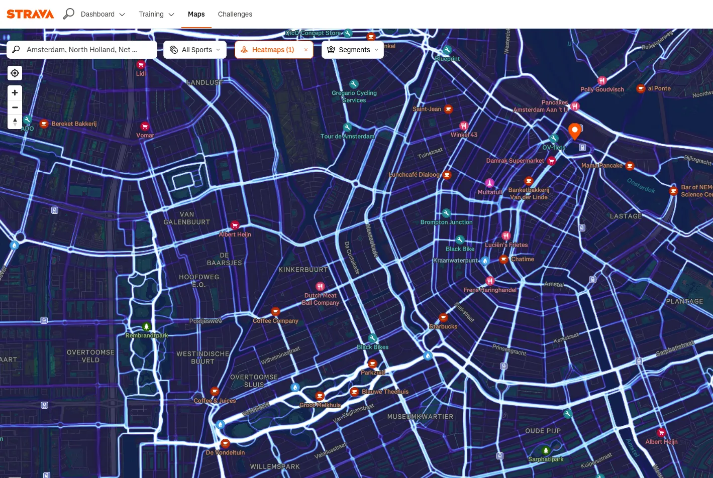
To get it set up you can reference the OSM wikipage for Strava.