ߏߔߌ߲ߛߑߕߙߌߕߑߡߊߔ ߛߌ߲ߞߐ߲ OpenStreetMap

erickdeoliveiraleal ߕߋ߬ߟߋ߲

ߕߋ߬ߟߋ߲ ߟߊ߬ߘߏ߲߬ߠߌ߲߬ߣߐ ߞߐߟߕߊ ߟߎ߬

Ativar camada Strava de alta resolução + OpenStreetMap (JOSM ou ID)

ߊ߬ ߟߊߦߟߍ߬ߣߍ߲߬ ߦߋ߫ erickdeoliveiraleal ߓߟߏ߫ 20 October 2020 ߦߋ߫ Portuguese (Português) ߟߋ߬ ߘߐ߫

Geração da URL

1-Baixe o plugin para o Chrome nesta URL: https://github.com/janosrusiczki/strava-heatmap-to-osm-background/archive/master.zip 2-Descompacte o plugin em alguma pasta do seu computador. 3-dentro da pasta descompactada do plugin edite o arquivo manifest.json (com bloco de notas), na linha 16 mude de [“heatmapToOSM.js”] para [“background.js”] 4-Abra o Chrome, clique nos 3 pontos e clique em Mais Ferramentas > extensões. 4 -Selecione a pasta descompactada e clique em carregar sem compactação 
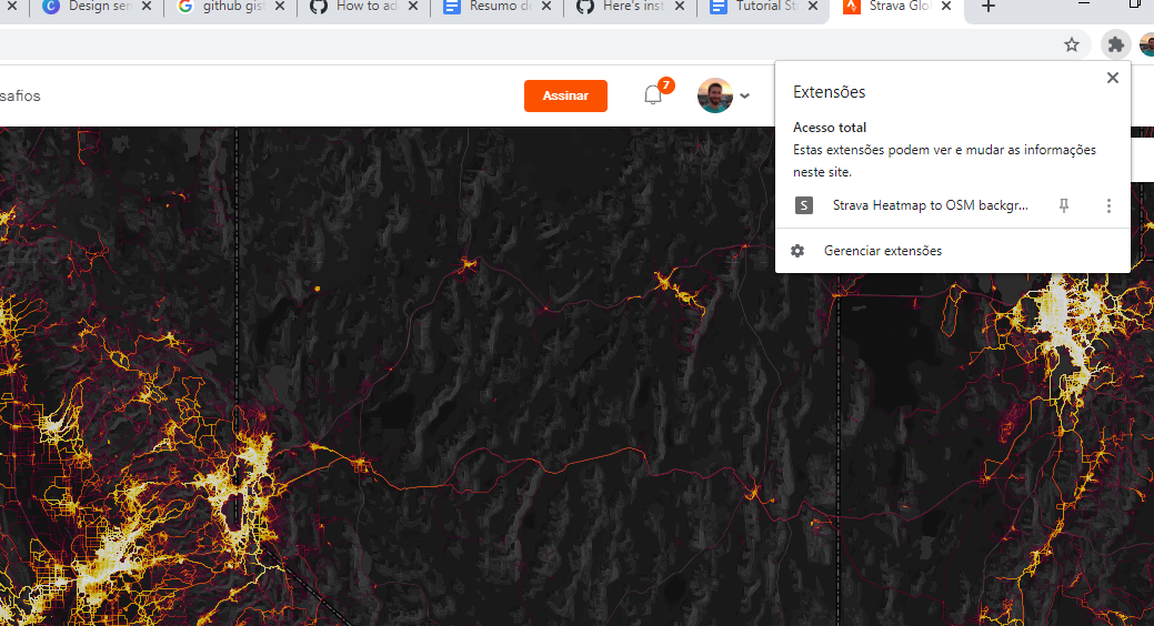
5 -Acesse o site https://www.strava.com/heatmap e faça o login. 6-após feito o login clique no ícone da extensão, isso copiará o endereço com os parâmetros necessários para vermos a camada em alta resolução. Image 1

Uso no ID:

See full entry

Enable Strava High Resolution Layer + OpenStreetMap (JOSM or ID)

ߊ߬ ߟߊߦߟߍ߬ߣߍ߲߬ ߦߋ߫ erickdeoliveiraleal ߓߟߏ߫ 20 October 2020 ߦߋ߫ English ߟߋ߬ ߘߐ߫

Generating the URL

1-Download the Chrome plugin at this URL: https://github.com/janosrusiczki/strava-heatmap-to-osm-background/archive/master.zip 2-Unzip the plugin in a folder on your computer. 3-inside the unzipped folder of the plugin edit the file (open with notepad) manifest.json, in line 16 change from [“heatmapToOSM.js”] para [“background.js”] 4-Open Chrome, click the 3 dots and click More Tools> extensions. 5 -click upload without compression and select the folder in your computer 6- Access the website https://www.strava.com/heatmap and login. 7 -after login, click on the extension icon, this will copy the address with the necessary parameters to see the layer in high resolution. Image 1

Use in ID:

See full entry

Editing Openstreetmap using Strava layer in iD editor

ߊ߬ ߟߊߦߟߍ߬ߣߍ߲߬ ߦߋ߫ erickdeoliveiraleal ߓߟߏ߫ 22 May 2020 ߦߋ߫ English ߟߋ߬ ߘߐ߫ ߟߊ߬ߞߎ߬ߘߦߊ߬ߟߌ߬ ߞߐߟߕߊ 26 May 2020 ߘߐ߫

For those who want to use the Strava layer in the iD editor, it’s very easy. First go to https://strava.com and login, then go to osm.org/edit, click the layers button -> custom -> paste the link: https://heatmap-external-{switch:a,b,c}.strava.com/tiles-auth/all/bluered/{zoom}/{x}/{y}.png?px=256. It appears only at the maximum zoom of 16 (disappears at very large zoom). This layer makes it much easier to find drawings of new roads that are not yet in the images.

Video tutorial: https://www.youtube.com/watch?v=VUABldSmPk4

Mapa rodoviário de Mato Grosso

ߊ߬ ߟߊߦߟߍ߬ߣߍ߲߬ ߦߋ߫ erickdeoliveiraleal ߓߟߏ߫ 13 November 2018 ߦߋ߫ Brazilian Portuguese (Português do Brasil) ߟߋ߬ ߘߐ߫

Excelente mapa para obter referências das rodovias pavimentadas/rural do Mato Grosso, revisei algumas, mas há muita coisa pra checar. http://sinfra.maps.arcgis.com/apps/MapSeries/index.html?appid=6150f1d5f9054c6cb554793e918e7bdb

Revisão Rodovias sem Ref no Tocantins

ߊ߬ ߟߊߦߟߍ߬ߣߍ߲߬ ߦߋ߫ erickdeoliveiraleal ߓߟߏ߫ 12 November 2018 ߦߋ߫ Brazilian Portuguese (Português do Brasil) ߟߋ߬ ߘߐ߫

Acredito que tenha conseguido adicionar 90% ou mais de refs nas rodovias do Tocantins. Utilizando a camada IBGE trechos de rodovias e mapa rodoviário https://www.seinf.to.gov.br/menu-lateral/mapas-rodoviarios/ <3

Ceilândia-Distrito Federal

ߊ߬ ߟߊߦߟߍ߬ߣߍ߲߬ ߦߋ߫ erickdeoliveiraleal ߓߟߏ߫ 19 May 2013 ߦߋ߫ Brazilian Portuguese (Português do Brasil) ߟߋ߬ ߘߐ߫

Cidade totalmente mapeada. Só falta endereçar agora.

ߘߌ߲߬ߞߌߙߊ: Setor N Norte, Guariroba, Ceilândia, Região Geográfica Imediata do Distrito Federal, Região Integrada de Desenvolvimento do Distrito Federal e Entorno, Região Geográfica Intermediária do Distrito Federal, Distrito Federal, Região Centro-Oeste, 72220-120, Brasil