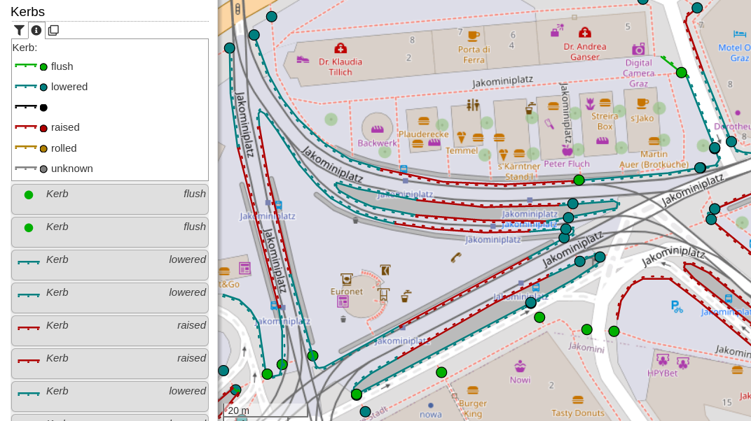
This new category shows kerbs (the edge where a road meets a sidewalk). Read more about this in the OpenStreetMap Wiki. The category uses the colours from the Wiki page. Popups will show additional information: type of kerb (lowered, raised, …), they wheelchair accessibility (if set), if the kerb has tactile paving and the height.

For discussion, please go to the OpenStreetMap Community Forum.
דיון