zstadler's Comments
| Changeset | When | Comment |
|---|---|---|
| 83154031 | about 5 years ago | Dear TWHB, In this edit you have deleted two important relations: 1948518 and 1948505. See "Separation Wall" at osm.wiki/Israel#Palestine_Related Can you clarify if this was done by mistake or what is the justification for their deletion. Best Regards,
|
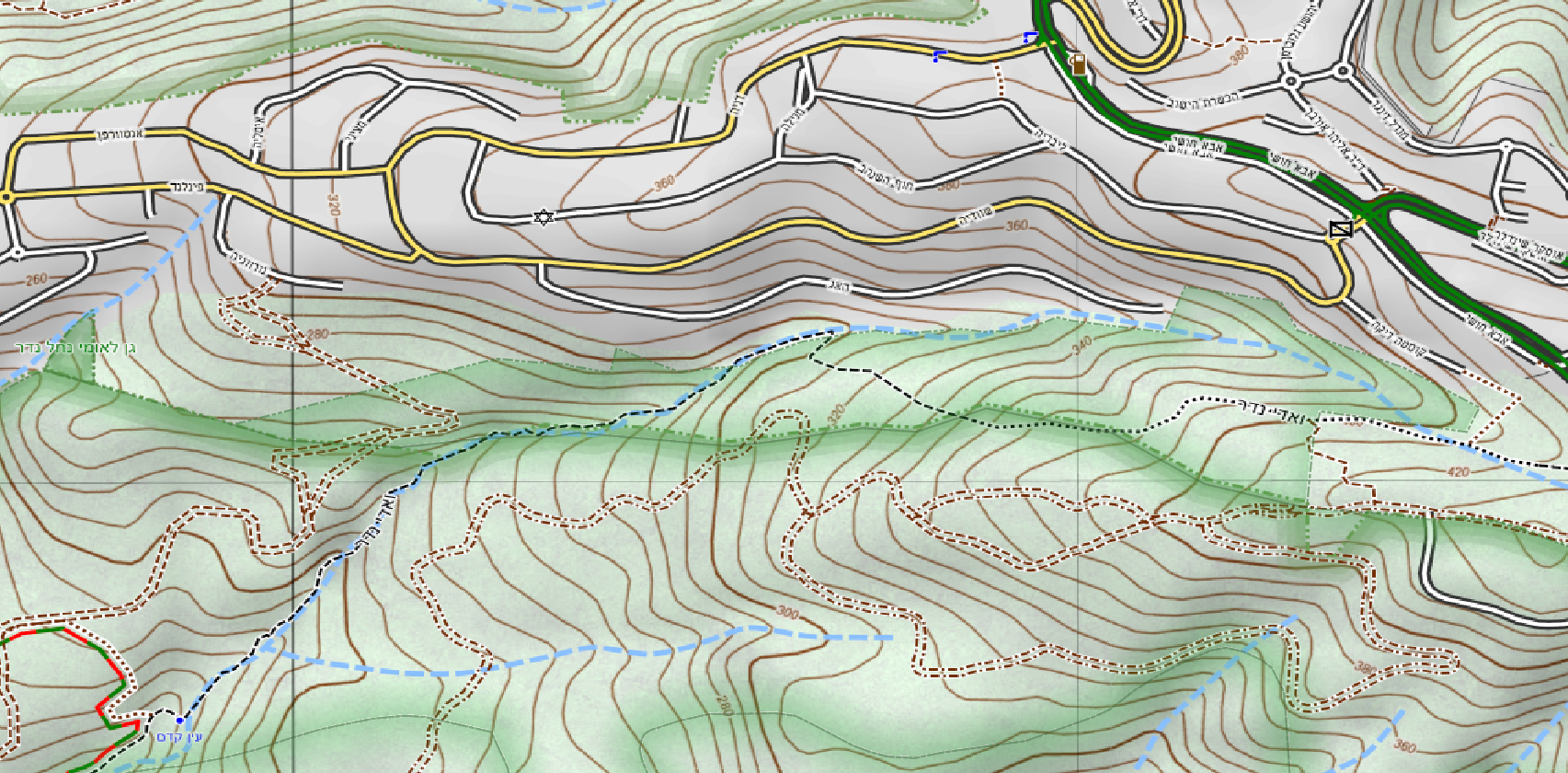
| 80660239 | about 5 years ago | Hi, It seems like the larger part of Nahal Neder National Park was not mapped yet. https://user-images.githubusercontent.com/1304610/85952903-19008c80-b975-11ea-85a3-dac3be109786.png Would you care to add it? Thanks! |
| 86822817 | about 5 years ago | Nice catch!
|
| 81951223 | about 5 years ago | Thanks! Done. |
| 81951223 | about 5 years ago | I left a comment to the original mapper in
|
| 81349433 | about 5 years ago | שלום נמרוד וברוך הבא ל
על פניו נראה שבעריכה זו מיפית מסלול טיול אישי ולא מסלול טיול שנבנה על ידי העירייה, החברה להגנת הטבע, או גוף רשמי כלשהו אם זה המצב, הרי ש,
זה מצויין למפות שבילים ודרכים למען כולם אבל זה לא המקום להכניס שמות של מסלולי טיול פרטיים ונקודות ציון שלהם למפה שמשרתת את כל המשתמשים. אנא הבהר את הכוונה בעריכה זו ואשמח לעזור לך לעשות זאת נכון בברכה,
|
| 81951223 | about 5 years ago | I understand that there is no evidence of a trail created by an official entity, such as the city. I'd be happy to delete the relation for it.
|
| 82924928 | about 5 years ago | Hi, The use of waterway=wadi is no longer recommended:
Please use water=stream or water=river with intermittent=yes Thanks,
|
| 83703788 | about 5 years ago | Hi, In this edit you have added an osmc:symbol" tag to a way. It does not have an itc relation, and its kkl relation does not have an osmc:symbol tag. Did you intend to put this tag on the kkl relation? |
| 81951223 | about 5 years ago | Hello Sanniu, In this changeset you have added a hiking relation for "מסלול מעגלי האירוס הנצרתי". Do you know is the operator of this hiking? Could it be a private plan of an new mapper, created in osm.org/changeset/81349433? Thanks,
|
| 74370918 | about 5 years ago | שלום דב, תודה על העדכון. האם הסגירה היתה קבועה או זמנית?
תודה,
|
| 56406246 | about 5 years ago | Hello Sivan00, In this changeset you have added a tourist information office osm.org/node/5415927785 near the Mazor Mausoleum.
|
| 22751806 | about 5 years ago | Hello Dror,
|
| 22504502 | about 5 years ago | Hello Dror,
|
| 48724347 | about 5 years ago | Hello Dror,
|
| 20591993 | about 5 years ago | Hello Dror,
|
| 75184514 | over 5 years ago | Hello Ophirh2, In this edit the tracktype of osm.org/way/730666408 was changed from grade3 to grade5. According to the Israel mapping guidelines at osm.wiki/Israel#Ways_Belonging_to_a_Trail
> Unpaved road requiring deferential locks and high clearance - "דרך עפר לרכב שטח "נעול It is very unusual to find such roads in a flatland like the Zvulun valley. tracktype=grade4 is also not common in such areas. Can you please revisit this classification? Thanks! |
| 81283696 | over 5 years ago | Hello Zero0000, I understand you are new to OSM.
Please see the OSM wiki regarding the "subarea" tag: "Optional, disputed and redundant (references to sublevels may also be found with spatial queries, provided that there's no overlap between similar subdivisions). Also referencing other relations makes editing more complicated in some cases." source: osm.wiki/Relation:boundary#Relation_members Best regards,
|
| 81283696 | over 5 years ago | Hello Onceinawhile, The changes in this edit are unrelated to any political event or view. As the title says, the "subarea" members of the relations were removed because the use of such members is disputed and redundant. Best regards,
|
| 60829386 | over 5 years ago | Thanks! |