This is a compilations of what I sent to other people.
I have taken it from the cadastre at (https://seduvi.cdmx.gob.mx/programas-delegacionales-de-desarrollo-urbano), I was extremely surprised that CDMX’s cadastre has not being used because it is in the public domain (“Este programa es de carácter público, no es patrocinado ni promovido por partido político alguno y sus recursos provienen de los impuestos que pagan todos los contribuyentes.”) You only need to credit the source: “Agencia Digital de Innovación Pública “Sistema Abierto de Información Geográfica (SIGCDMX)” Disponible en: https://sig.cdmx.gob.mx/”.
After reading osm.wiki/Import/Guidelines, I will make a import page for CDMX data to serve as a documentation for where the data comes from.
Step 1
I download the data from (https://sig.cdmx.gob.mx/datos/descarga). There are two types of data there, the actual cadastry data “Descarga de datos del catastro” and landuse data “Descarga de datos SEDUVI”. The cadastry data is basically a bunch of points and I find that the only useful data there is the address data, which is fairly inaccurate.
It is better to download the landuse data since it has the polygons to work with. I download the shapefile from the “Descarga de datos SEDUVI” section. I’m working at Cuauhtémoc alcadia because it is the central alcadia of CDMX
Generally, since houses in Mexico are connected to each other, often the landuse is the building footprint itself. But, for more complex places like schools, churches, hospital, government areas, etc. it only covers the surrounding of the complex.


 En las ciencias geoespaciales y la inteligencia de ubicación, las isócronas representan áreas geográficas accesibles en un tiempo determinado desde un punto específico. Por ejemplo, en el contexto de las distancias a pie, las isócronas son herramientas útiles para profesionales como los urbanistas que buscan comprender la accesibilidad y la conectividad dentro de un área determinada.


 Monte Alcuza (

 El Humedal El Totoral es un ecosistema estratégico que enfrenta diversas presiones ambientales, como la expansión agrícola y ganadera, la urbanización descontrolada y el uso inadecuado de agroquímicos. Para comprender mejor estos problemas y generar datos abiertos sobre el territorio, organizamos una jornada de mapeo comunitario con ChatMap, una herramienta innovadora para la ciencia ciudadana.

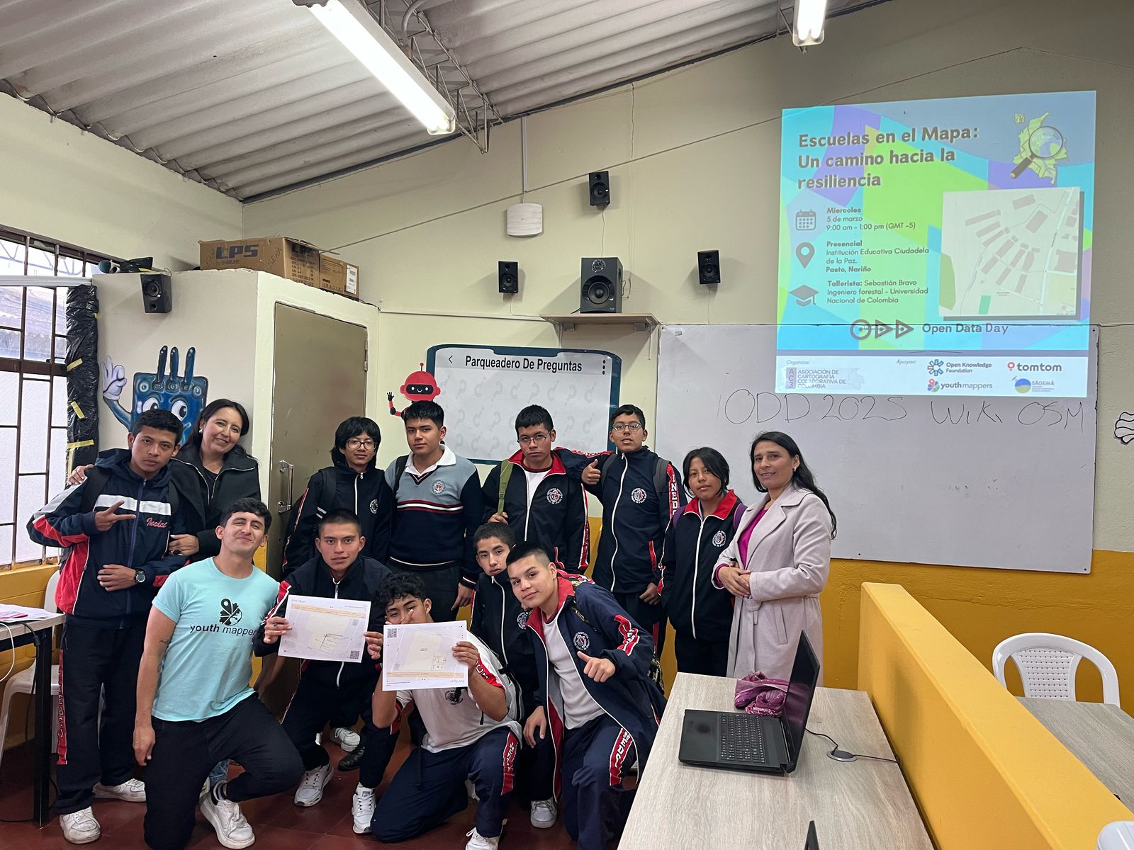
 Nuestro objetivo principal fue mapear la infraestructura de las instituciones educativas en el departamento de Casanare. Este mapeo incluyó no solo los edificios, caminos y vías, sino también áreas naturales como jardines, árboles, prados y otros elementos. A través de OpenStreetMap, pudimos identificar múltiples áreas y elementos, empleando técnicas de fotointerpretación con las imágenes de **BING y ESRI disponibles en la aplicación.