Espero está sea mi ubicación exacta
Users' Diaries
Recent diary entries
peta
Posted by custodiankeyy on 13 July 2025 in English.
Last updated on 12 August 2025.
For Turkey: (For Ankara, see keyyushi.)
-
Revert/tag correction operations
-
Map verification
Suspicious OSM Changesets It is recommended to change the parameters!
test
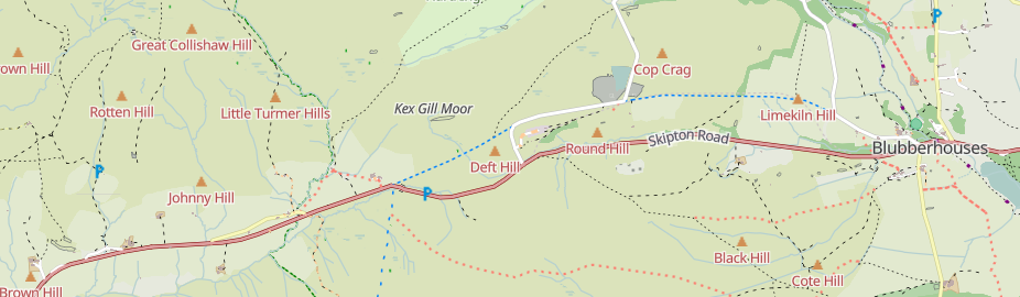
Kex Gill (humorously named the “Côte de Blubberhouses” for a stage of the 2014 Tour de France) is a road in Yorkshire between Harrogate and Skipton. Part of it is gradually sliding down the valley that it is built half-way up the side of and is being rebuilt; it was the access tags on bridleways there that caught my eye in the first place.

The twenty-fourth development diary marks the most significant milestone in OpenStreetMap-NG’s journey to date: the launch of our public test instance. After months of intensive development, we’re finally excited to show it all off! This isn’t just a technical achievement—it’s a pivotal moment in our mission to revolutionize open-source mapping.
🔖 You can read other development diaries here:
https://www.openstreetmap.org/user/NorthCrab/diary/
⭐ This project is open-source — join us today:
https://github.com/openstreetmap-ng/openstreetmap-ng
🛈 This initiative is not affiliated with the OpenStreetMap Foundation.
Public Test Instance Launch 🚀
OpenStreetMap-NG is now live for public testing at osm.ng. This milestone represents months of intensive development, optimization, and preparation to create a stable testing environment for the community. Every mapper, developer, and OpenStreetMap enthusiast can now experience what we’ve been envisioning as the next generation of mapping platforms.
The test environment runs completely independently from the main OpenStreetMap infrastructure. It features the complete OpenStreetMap dataset while providing a safe playground for experimentation and feedback. You can explore all the functionality without worrying about affecting live data—perfect for giving the platform a thorough evaluation.
Liftoff! We have a liftoff, 32 minutes past the hour. Liftoff on Apollo 11.
CloudFerro Infrastructure Partnership
Posted by UrbanRoaming on 10 July 2025 in English.
Last updated on 13 July 2025.

OpenStreetMap went viral! Well, sort of.

A recent Instagram video highlighted an area where Pokémon Go had better trail coverage than Google Maps. You can see for yourself:
Currently, the video has over 12.6 million views and 733 thousand likes!
As you probably know, Pokémon Go uses OSM for its map data. So it’s cool seeing it acknowledged that OSM data performed better, even if it was misguided as a compliment towards Pokémon Go/Niantic.
With a little bit of searching, I found the path that they were on: Way #518694188. Added 8 years ago by BikeRoad.
Hallo,
ich konnte nichts finden und habe auch noch keine gute Idee wie man das hier mappt:
Wer kann helfen?
Netten Gruß bwbuz
-3.423250
OSM有多个含义,但最常见的是指“OpenStreetMap”,即“开放街道地图”。
OSM(开放街道地图)详解: 定义:一个由全球志愿者共同创建和维护的免费开源地图数据库项目。 特性:数据可被任何人自由使用、编辑和共享,这与许多商业地图服务的限制性许可形成鲜明对比。 数据来源:志愿者通过实地测绘、卫星图像分析、公共数据整合等方式贡献。 应用场景:广泛应用于导航、地理信息系统(GIS)分析、研究、商业服务、应急救援、城市规划、交通规划、旅游、学术研究等多个领域。 此外,OSM还提供了丰富的API和各种工具,方便开发者将这些数据集成到各种应用程序中。
Posted by jimkats on 9 July 2025 in Greek (Ελληνικά).
Καλησπέρα σε όλους/όλες,
Ως μέλος της ελληνικής κοινότητας του OpenStreetMap, θα ήθελα να σας προσκαλέσω σε συνάντηση της κοινότητας, πρωτίστως διαδικτυακή και μετέπειτα από κοντά, ώστε να γνωριστούμε καλύτερα και να συζητήσουμε διάφορα σχετικά με το OSM.
Για την διαδικτυακή συνάντηση:
🗓️Ημερομηνία και ώρα: Τετάρτη 16 Ιουλίου, 20:00
🔗Σύνδεσμος δωματίου συνάντησης: BigBlueButton
Το BigBlueButton, για όσους δεν ξέρουν, είναι το λογισμικό συναντήσεων που χρησιμοποιεί το OSMF. Για την σύνδεση στο δωμάτιο, αρκεί να βάλετε το όνομα σας, δεν είναι απαραίτητη κάποια εγγραφή.
🗓️🔗Σύνδεσμος συνάντησης στο OpenStreetMap Calendar: https://osmcal.org/event/3894/
Δεν υπάρχει συγκεκριμένη ατζέντα για το τι θα συζητήσουμε, γι’ αυτό γίνεται αυτή η αρχή για κάνουμε μια πρώτη γνωριμία, να δούμε τι θέματα υπάρχουν σαν ελληνική κοινότητα στο OpenStreetMap, και μια γενική συζήτηση για διάφορα περί OSM.
Θα συζητήσουμε επίσης για τα τελικά της δια ζώσης συνάντησης στην Αθήνα, η οποία λογικά θα γίνει Σάββατο 26 Ιουλίου, 3 το μεσημέρι, στο Piu Verde στο Άλσος Παπάγου. Θα βγει νέα δημοσίευση όταν οριστικοποιηθούν οι λεπτομέρειες.
Δείτε την αντίστοιχη δημοσίευση στο φόρουμ, όπου θα δημοσιεύονται οι κύριες πληροφορίες: https://community.openstreetmap.org/t/topic/132512
Για επικοινωνία με τα υπόλοιπα μέλη της ελληνικής κοινότητας, πέραν του φόρουμ, για πιο άμεση επικοινωνία στο τσατ Element.
Σας ευχαριστώ και ελπίζω να ιδωθούμε,
jimkats
Working independently to help plot missing areas but conscious of the current geopolitical situation. Can anyone recommend if there’s any areas to be mapped out of urgency? For instance Texas with the current floods, Gaza or Ukraine etc for the humanitarian issues and destruction of war. I want my work to have as much positive impact and possible and consequentially don’t want to be plotting somewhere remote in say Africa for instance when actually somewhere else is in a much more urgent and desperate need. Many thanks.
مرحبًا بكم في مؤسسة راشد للنظارات، وجهتكم الأولى للبصريات في مدينة الرياض. نقدم لكم مزيجاً من الخبرة والابتكار في عالم العناية البصرية:
- 👓 نظارات طبية وشمسية بأحدث الموديلات
- 🔬 فحص نظر متقدم بأجهزة دقيقة
- 🧑⚕️ استشارات من خبراء مختصين
- 🚗 سهولة الوصول ومواقف مخصصة للعملا
ENGLISH
So, really it’s Gorgona Scalo (or something similiar) to La Spezia Migliarina (cuz of the tunnels, tunnels = no gps = no mapping)
Come with me in the train, (and map anything useful!)
ITALIAN
Quindi, in realtà è da Gorgona Scalo (o qualcosa di simile) a La Spezia Migliarina (a causa delle gallerie, gallerie = no gps = no mapping).
Venite con me in treno, (e mappate tutto ciò che è utile!)
GERMAN
Also, eigentlich geht es von Gorgona Scalo (oder so ähnlich) nach La Spezia Migliarina (wegen der Tunnel, Tunnel = kein GPS = keine Karte)
Komm mit mir in den Zug (und zeichne alles Nützliche ein!)
TRANSLATE IN YOUR LANGUAGE!
by clicking here / this button, you can translate in your language
pss. pss.. deepl translator. not gugglu :)

개인적으로 참고하기 위해 작성한 항목입니다. (수시 업데이트)
도로
- enforcement 관계: 교통법규 단속 장비
- change 키: 차로 변경 가능 여부
- expressway 키: 고속화도로 여부
- motorroad 키: 자동차전용도로 여부
철도
- railway=milestone: 거리표
Posted by Raquel Dezidério Souto on 6 July 2025 in English.
FREE AND OPEN REGISTRATION FOR THE III WORKSHOP ON PARTICIPATORY MAPPING AND SOCIAL CARTOGRAPHY - MPCS 2025
You can now register for the collective mapping event of 2025. Thank you to everyone who sent their contributions!
We’ll see you in August at the event, which is 100% online and completely open to the public. Registration at:
https://ivides.org/workshopmpcs2025
The actual event numbers are:
- 133 speakers
- 36 Projects in the Mapping Exhibition
- 20 book chapter presentations
- 9 Special Keynotes with invited experts
- 1 OpenStreetMap training session + 01 Mapathon
- 1 book release [90 authors and 20 chapters]
To keep contact: ivides@ivides.org

Posted by Raquel Dezidério Souto on 6 July 2025 in Portuguese (Português).
INSCRIÇÕES LIVRES E ABERTAS PARA O III WORKSHOP MAPEAMENTO PARTICIPATIVO E CARTOGRAFIA SOCIAL - MPCS 2025
Você já pode se inscrever para o maior evento de mapeamento coletivo de 2025. Agradecemos a participação de todos que enviaram as suas contribuições!
Nos veremos em agosto, no evento 100% online e completamente aberto ao público. Inscrições em:
https://ivides.org/workshopmpcs2025
Números do evento até o momento:
- 133 palestrantes
- 36 Projetos na Mostra de mapeamento
- 20 Apresentações de capítulos do livro
- 9 Palestras especiais com especialistas convidados
- 1 Oficina de OpenStreetMap + 01 Mapatona
- 1 Lançamento de livro [90 autores(a) e 20 capítulos]
Posted by Ducminhduongcb on 6 July 2025 in Vietnamese (Tiếng Việt).

Tôi vừa hoàn thành một đợt cập nhật dữ liệu hành chính tỉnh Cao Bằng trên bản đồ OSM, dựa theo các nghị quyết chính thức của Quốc hội Việt Nam về việc sắp xếp lại các đơn vị hành chính cấp huyện và xã trong giai đoạn hiện đại.
🗂️ Tổng hợp quá trình sáp nhập: 2000–2019:
Tỉnh Cao Bằng duy trì 13 huyện và ~199 xã/phường/thị trấn.
Không có thay đổi lớn, chỉ có điều chỉnh nhỏ về địa giới hành chính, tên gọi.
2020:
Theo Nghị quyết 864/NQ-UBTVQH14 (10/01/2020):
Sáp nhập huyện Thông Nông vào huyện Hà Quảng
Giảm 38 xã, từ 199 còn 161 xã/phường/thị trấn
2025:
Theo Nghị quyết 1657/NQ-UBTVQH15 (16/06/2025) và Đề án 383/ĐA-CP (09/05/2025):
Tỉnh giảm còn 56 xã/phường (53 xã + 3 phường)
Các phường mới của TP Cao Bằng:
Thục Phán (gồm: Sông Hiến, Hợp Giang, Đề Thám, Hưng Đạo, Hoàng Tung)
Nùng Trí Cao (gồm: Ngọc Xuân, Vĩnh Quang, Sông Bằng)
Tân Giang (gồm: Tân Giang, Duyệt Trung, Hòa Chung, Chu Trinh, Lê Chung)
Nhiều xã mới được thành lập như: Quang Long, Nam Quang, Hưng Đạo, Yên Thổ, Sơn Lộ…
Từ 01/07/2025, mô hình chính quyền 2 cấp (tỉnh → xã/phường) chính thức áp dụng tại Cao Bằng.
Just completed an update of administrative boundaries for Cao Bang Province (Vietnam) in OpenStreetMap, based on official government resolutions about merging lower-level administrative units.
🗂️ Summary of the process: 2000–2019:
The province had 13 districts and ~199 communes/wards/townlets.
No major changes, only minor adjustments.
2020:
Under Resolution 864/NQ-UBTVQH14 (Jan 10, 2020):
Thong Nong District merged into Ha Quang District
Number of communes reduced from 199 to 161
2025:
Under Resolution 1657/NQ-UBTVQH15 (June 16, 2025) and Plan 383/DA-CP (May 9, 2025):
Province reorganized to just 56 communes/wards (53 communes + 3 wards)
New wards of Cao Bang City:
Thuc Phan (from Song Hien, Hop Giang, De Tham, Hung Dao, Hoang Tung)
Nung Tri Cao (from Ngoc Xuan, Vinh Quang, Song Bang)
Tan Giang (from Tan Giang, Duyet Trung, Hoa Chung, Chu Trinh, Le Chung)
OSM모임이나 협회 같은거 우리나라에도 있으면 좋겠다 바로 옆나라 일본도 있던데